Download PDF
Download page Introduction to Parametric Area Reduction in HMS.
Introduction to Parametric Area Reduction in HMS

HEC-HMS version 4.14 beta 1 build with the Parametric ARF Fitting tool was used to created this tutorial. You will need to use this HEC-HMS version 4.14 or newer, to open the project files.

Download the initial model files here - Parametric_Area_Reduction_Initial.zip
Download the HMR 51 storms catalog for TX - HMR51_TXstorms.zip
Overview
Frequency based precipitation information is often available for point, or precipitation gage, locations. When applying point precipitation to a watershed, depth-area reduction (DAR) factors are required to reduce the point precipitation to an average depth that occurs over the watershed. The general pattern observed from historic storms is that the rainfall magnitude decreases as storm area increases. Therefore, depth-area reduction curves are a required component to account for the storm, or watershed, area.
HEC-HMS can automatically apply an area-reduction factor based on the storm area entered into either the Frequency Storm or Hypothetical Storm meteorologic models. However, the area-reduction curves that are hardcoded into HEC-HMS are from Technical Paper No. 40 and may not be accurate for watersheds larger than 400 square miles. The TP40 reduction curves were developed using only drainage areas of 400 square miles or less so the curves flat line and use similar reduction factors for storm area over 400 square miles. As storm areas increase in size, the reduction factor should continue to decrease. Also, there is evidence that area-reduction varies across the country. For this reason, a new Parametric option exists in HEC-HMS where modelers can parameterize their own single area reduction function that is a function of storm area and storm duration.
When using the User-Specified option, the workflow is to use a published depth area reduction relationship, or to develop a single function based on computed depth area duration tables of an observed storm for a given duration. The Parametric option allows the user to parameterize a general function to work across a range of durations based on observed depth area duration tables. In theory, a single function developed from one or more observed storms should work for a large range of storms of varying duration for a region of interest. The main difference between the two options is the inclusion of the Duration term in the parametric function. This also allows the user to combine areal reduction patterns from multiple observed storms to account for the uncertainty in areal reduction when modeling a hypothetical event.
In this tutorial and guide, you will learn how to create site specific area-reduction curves from existing storm catalog or individual storm depth area reduction tables. By applying site specific area-reduction factors to your flow frequency studies, you can improve the accuracy of the area-reduced rainfall depths for your local watershed.
In this tutorial, you will become familiar with Parametric Area Reduction methods that are available within HEC-HMS. Specifically, you will:
- Input depth area duration data into HMS
- Fit area reduction parameters to observed storm data
- Run a simulation with the Parametric area reduction method
Background
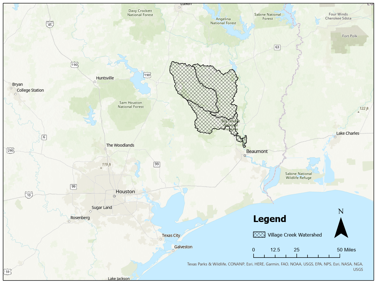
With a parametric area reduction method, a single function can be applied to a diverse range of sites and account for local conditions by altering the parameters. Within HEC-HMS, parametric area reduction is performed based upon the DeMichele dynamic scaling model (DeMichele et al., 2000). The DeMichele model is a function of area A (mi^2 or km^2) and duration D (hours) with four parameters w, b, z, and v. You will be using an HEC-HMS model of the Village Creek watershed for this workshop. This watershed is located near Beaumont, Texas in the southeastern portion of the state and is approximately 1,130 square miles. A location map and an image of the HEC-HMS basin model configuration can be seen below. The
The HEC-HMS uses a Levenberg-Marquardt algorithm to fit the four parameters w, b, z, and v to the DeMichele scaling model based on the input depth area duration data. The data can be accessed from the extreme storms database or HMR reports. The DeMichele model for Areal Reduction Factor, ARF, as a function of area, A, and duration, D, is shown below:
| ARF(A,D)=[1+w\left\lbrack\right.\frac{A}{D}^z]^b]^{-\frac{v}{b}} |
where w is the normalization factor,
b is the constant scaling exponent,
z is the dynamic scaling exponent,
and v is the Holder exponent.
Continue to Accessing Data and Setting up Meteorologic Model