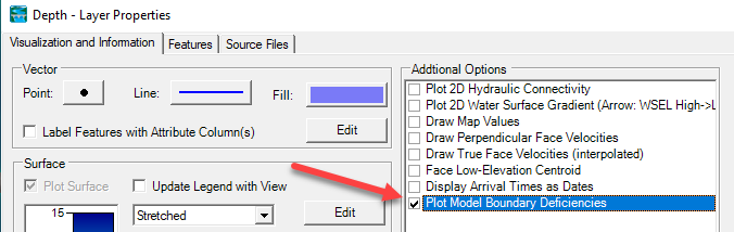
Riprap and Scour Calculator: HEC added a Riprap and Scour Calculator to the Hydraulic Design. This tool uses HEC-RAS results to compute riprap size, gradation and thickness, and the potential scour depth to design toe protection. The User's Manual and tutorial video are here.
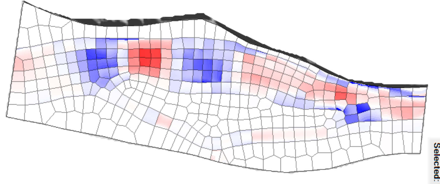
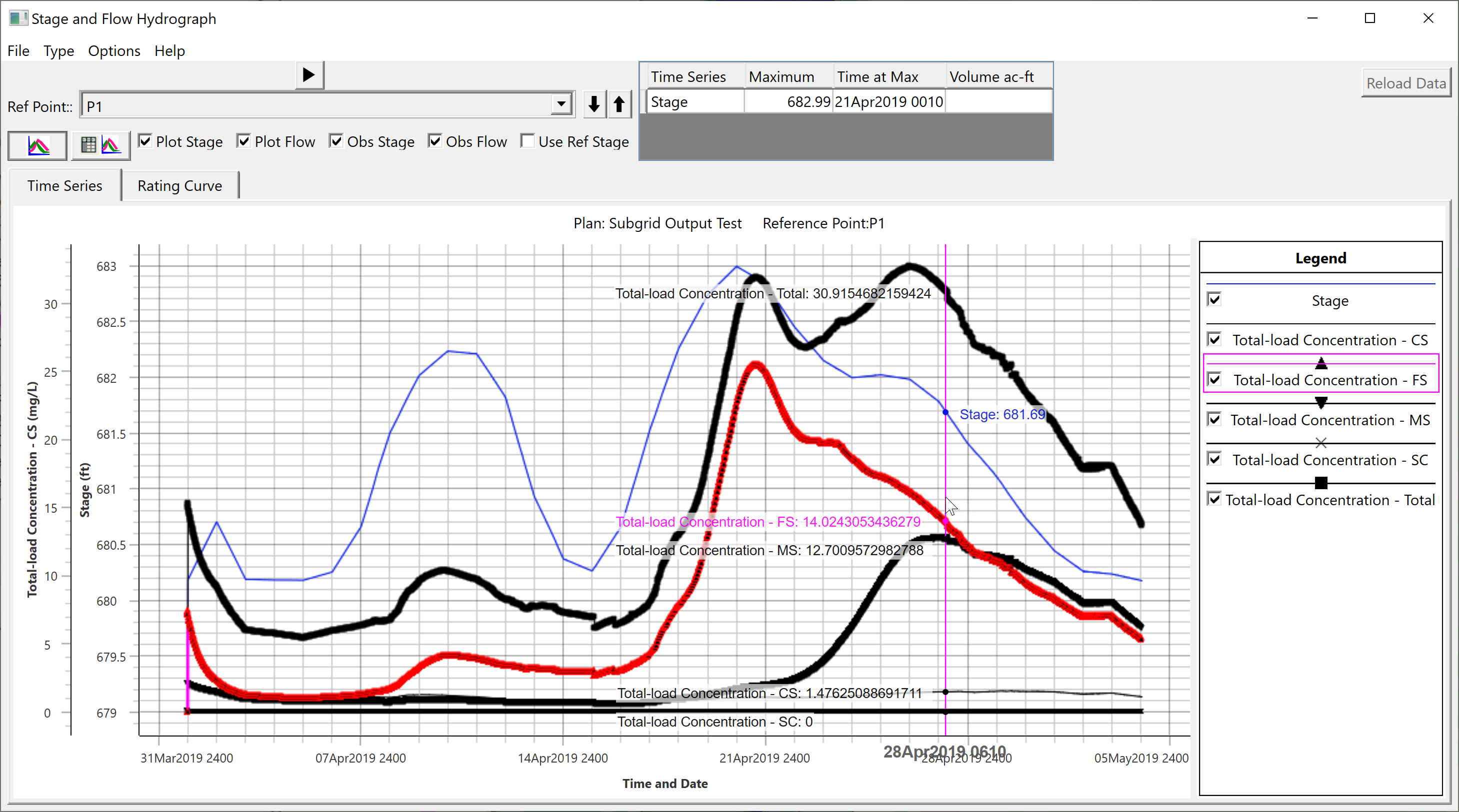
2D Sediment Transport. HEC-RAS 6.1 is the first official release of 2D sediment transport. You can find the User's Manual here and Technical Reference Manual here. This release includes several new features and bug fixes from the beta version 6.0. New features include subgrid scale spatial mapping, animated subgrid property tables, and time-series plots at Reference Lines and Reference Points (see figures below).
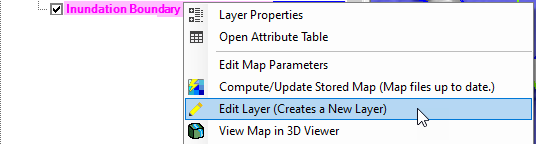
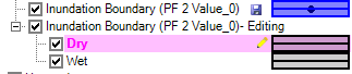
Inundation Boundary Editing: The inundation boundary is created as a multipart shapefile. New editing tools were developed to allow the user to edit this polygon dataset. This is discussed in the RAS Mapper User's Manual here.
Editing a multipart polygon derives a new layer group with "wet" and "dry" parts. (If you are editing just a normal multipart polygon, these will be referred to as "Parts" and "Holes".)
The wet and dry polygons are edited separately. The new layer is saved back to a multipart polygon, when the user stops editing. The original inundation polygon is preserved.
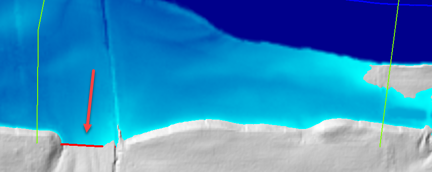
Inundation Boundary Deficiency Plot: A new plot options is available to show the user where the inundation boundary is being limited by the model domain (such as cross sections are not wide enough to capture the entire floodplain). This tool can be helpful in model analysis and refinement. This is discussed in the RAS Mapper User's Manual here.
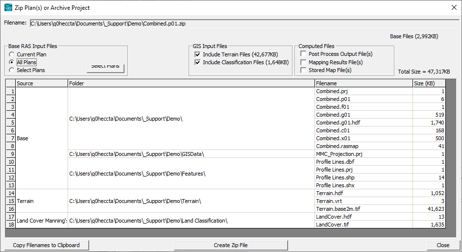
Model Archive: Zipping up an HEC-RAS model for archival now allows for multiple plans and simulation data to be included in the zip archive. This capability is available from the File | Zip Plan(s) or Archive Project menu item. This is discussed in the HEC-RAS Mapper User's Manual here.
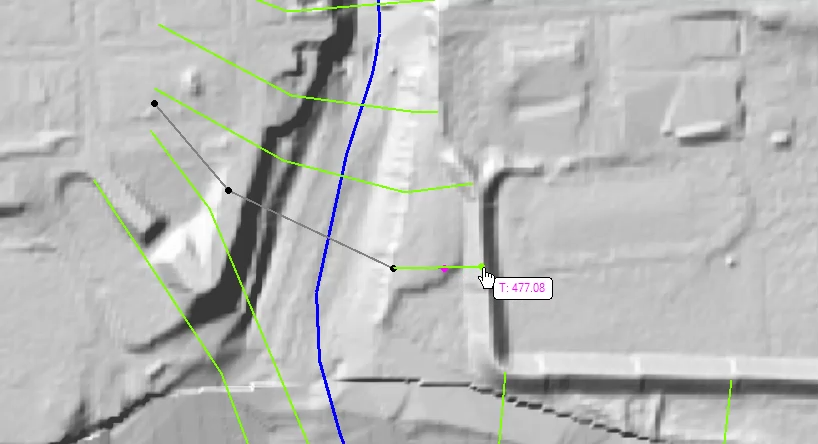
Watch Layer Value on Cursor when editing: The user can now (if desired) turn on a layer value for the cursor tool tip when editing a feature. Just add the Terrain layer to the Watch Layer List. This is intended to assist users when laying out cross sections to finish on high ground.
Contours for Results Maps: Users can generate contours for RAS Results by right-clicking on the layer. The option is located on the Export Layer | Create Vector Contours (BETA) menu item. Contouring a dataset is discussed in the RAS Mapper User's Manual here.
Minor Improvements
Can toggle on/off various lines in new Hydrograph plotter through the Options | Variables menu item.
Can toggle currently plotted lines via checkbox next to line name on legend.
New hydrograph plotter bobber for displaying values.
New warnings about potentially bad projection file in RAS Mapper.
Snapshots created during a simulation run will automatically add to RAS Mapper.
Improved mesh point rendering speed.
Clip Terrain to Geometry Extents improved, no longer use bounding box extent of polygons.
Renaming layers overhaul: renaming is now done through a right click menu item, can no longer rename by clicking layer name.
Better random color choice in boundary condition plots.