Download PDF
Download page The Shared Watershed Schematic.
The Shared Watershed Schematic
The watershed schematic and its components were designed to be shared (implemented) across the various HEC software and the model integrating software packages HEC-WAT and CWMS. In ResSim, as well as HEC-WAT and CWMS, the shared watershed schematic embodies a set of schematic components that a sequence of models are intended to represent.
The components that make up a watershed schematic include the stream alignment, computation points, projects, and impact areas. These components are created in the Watershed Setup module of ResSim and combined represent the watershed schematic.
Projects are collected into sets called configurations. Configurations are unique sets of projects that when combined with the common stream alignment, computation points, and impact areas defining unique watershed schematics; thus configuration is often used as a synonym for watershed schematic since the configuration is what makes each schematic unique.
For example, a watershed modeling team may create two watershed schematics (configurations): an "existing conditions" configuration that includes all the reservoirs, diversions, gages, levees, and other points that currently exist in the watershed and a companion "without levees" configuration that includes all the same schematic elements except for the levees. The expectation of the modeling team that developed the two configurations is that a different set of individual models will be needed to reflect each configuration. In reality, some of the models may be appropriate to both configurations while other models may only be appropriate to one configuration or the other.
ResSim, HEC-WAT, and CWMS have all adopted the shared schematic concepts and implemented the associated Watershed Setup module. Other HEC models have not included the Watershed Setup module in their design but have reflected selected shared watershed schematic components in their native model schematics. The stream alignment and the computation points are the most widely represented shared watershed schematic components.
The Stream Alignment
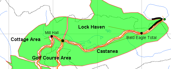
The Stream Alignment represents the river and stream network of a watershed (Figure: Stream Alignment). It appears in every ResSim module, but can only be created and edited in the Watershed Setup module. Streams, Stream Nodes, and Stream Junctions are the elements of a Stream Alignment. See The Stream Alignment for detailed information on creating and editing the Stream Alignment.

The Stream Alignment is the foundational element of the watershed schematic; all other schematic elements have some relationship to the stream alignment; either they are positioned at a specific station along a stream or they are located relative to a stream.
Computation Points
Computation Points (Figure: Computation Points) are point features within the shared schematic where data is exchanged between models (e.g., between ResSim and HEC-HMS). These points are placed on the Stream Alignment and usually represent gages, confluences, or model element boundaries (e.g., the inflow and outflow points of a reservoir). ResSim represents Computation Points with Junction elements in the model schematic of a Reservoir Network.

Project Elements
Projects (Figure: Project Elements) are man-made features in the watershed that affect flow in the river system. Project elements that can be placed in the watershed schematic include Reservoirs, Levees, Diversions, Channel Modifications, Off-Channel Storage, and Other Projects like pump stations and in-line spillways.

ResSim can directly represent reservoirs and diversions in its model schematic with reservoir and diversion model elements, but there is no direct parallel for any other project element as a ResSim model schematic element. However, with some creativity, you may be able to represent the other project elements using one or more of the available model elements. For example, a channel modification could be represented with a routing reach with specific routing parameters that reflect the smoother, faster reach.
Impact Areas
Impact Areas (Figure: Impact Areas) are watershed schematic elements that represent distinct portions of a watershed affected by rising water where flood damages may be evaluated. Impact areas can be included in your ResSim watershed for consistency with your HEC-FIA model; however, since ResSim cannot directly represent impact areas as model elements, only the computation points corresponding to the index locations for the impact areas can be represented in your ResSim model.
For more information about Impact Areas, refer to the HEC-FIA User's Manual.