Introduction to Calibrating a Continuous Simulation Model
Background
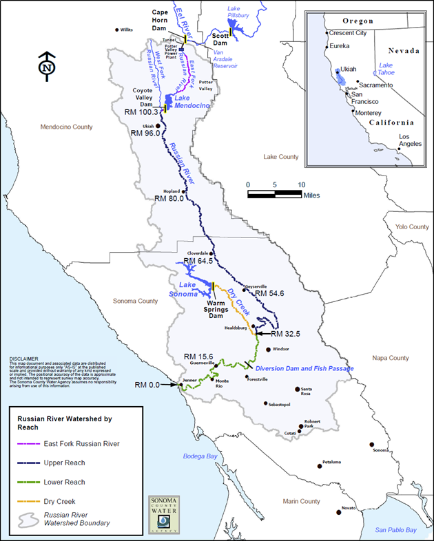
Coyote Valley Dam (Lake Mendocino) is located on the East Fork of the Russian River, about 2 miles north east of Ukiah California. Below the Coyote Valley Dam, the East Fork of the Russian River flows a very short distance (approximately 1 mile), until it merges with the main Russian River. The total drainage area for the watershed above Coyote Valley Dam is approximately 105 square miles. A map of the Russian River basin is shown in Figure 1.
Coyote Valley Dam and Lake Mendocino were the focus of a recent forecast informed reservoir operation (FIRO) study. A continuous simulation of the 60 year period 1951-2010 was created using historical observations. Different reservoir operation scenarios were tested for the 60 year period, using the calibrated model. A key component to the hydrologic modeling was accurately recreating reservoir inflows.
Objectives
In this workshop you will learn methods for calibrating a continuous simulation model. You will learn how to extract model output time series using HEC-DSSVue and evaluate the time series for model calibration.
Overview
In this workshop you will:
- Calibrate the Deficit & Constant Basin Model for a Single Water Year
- Calibrate the Soil Moisture Accounting Basin Model for a Single Water Year
- Calibrate the Deficit and Constant Basin Model to Observed Annual Maximum Flows
- Calibrate the Soil Moisture Accounting Basin Model to Observed Annual Maximum Flows
- Calculate Performance Metrics for Daily Flows
- Validate an HEC-HMS Model using Flow Frequency
Spend approximately 25 minutes per task to accomplish this workshop within the time allotted.
Continue to Calibrate the Deficit & Constant Basin Model for a single water year
