Download PDF
Download page Creating an Inverse Distance Precipitation Model.
Creating an Inverse Distance Precipitation Model
Return to Gridded Precipitation Method
Last Modified: 2025-01-29 07:22:49.116
Software Version
HEC-HMS version 4.13-beta.4 was used to create this example. You can open the example project with HEC-HMS 4.13 or a newer version.
Project Files
Download the initial project files here:
Note: The initial project file is the same for the Gage Weights Precipitation, Gridded Precipitation, and Inverse Distance Precipitation tutorials. If you are completing all three tutorials, the files only need to be downloaded once.

Introduction
This tutorial demonstrates the creation of a meteorological model that uses the inverse distance method. You will create a HEC-HMS Meteorologic Model that uses the inverse distance method to model the May 1996 precipitation event in the Mahoning Creek watershed. The inverse distance method is an interpolation method that weights the gage data based on the gage locations. The basic premise is that gages that are closer to a specific area will be weighted more heavily than gages that are a further distance away. The gage network has already been associated with time-series data in the HEC-HMS model. For more information on creating precipitation gage time-series, see Creating Time Series Data. The watershed has been represented using a single subbasin for the entire drainage area above the Punxsutawney stream gage.

Step 1. Begin by opening up HEC-HMS 4.13-beta.2 or later. The project contains several elements in the Watershed Explorer, as below:

Step 2. Expand the Basin Models node, the Meteorologic Model node, and the Time-Series Data | Precipitation Gages node of the Watershed Explorer tree. In this tutorial, we will be using the May1996 Basin Model (which was also used in the Gage Weights Precipitation Method tutorial). The Sep2018 model was used in the Gridded Precipitation Method tutorial. We will be using the same three precipitation gages that were setup previously in the Gage Weights Precipitation Method tutorial. With the Gage Weights method, the user specifies the depth weights and time weights that HEC-HMS uses to interpolate the gaged rainfall data. With the Inverse Distance method, the gages need to have a specified location (e.g., latitude and longitude) before the inverse distance weighting algorithm can be applied.
Creating the Meteorologic Model
Step 3. Select each of the three precipitation gages and enter in their respective location information in the Component Editor. Their latitude and longitude values can be found in the table below. If the time series gage has decimal degrees for latitude and longitude you can switch to degrees, minutes, and seconds in Tools > Program Settings > General.
| DUJP | MFFP | PNXP | |
|---|---|---|---|
| Latitude Degrees | 41 | 40 | 40 |
| Latitude Minutes | 7 | 58 | 56 |
| Latitude Seconds | 33 | 48 | 21 |
| Longitude Degrees | -78 | -78 | -79 |
| Longitude Minutes | 45 | 41 | 0 |
| Longitude Seconds | 50 | 22 | 31 |
Step 4. The two Meteorologic Models that are currently in this project are from previous tutorials. Create a new Meteorologic Model by using the Components menu, then selecting Create Component > Meteorologic Model....
Components I Create Component I Meteorologic Model
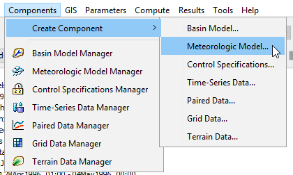
Step 5. For the name enter May 1996 Inverse Distance. Descriptions are optional but generally good practice; enter DUJP-MFFP-PNXP inverse distance. Press Create to create the new met model.

Step 6. Expand the Meteorologic Model node of the tree to see the Met Model you just created. Click on it to select it and so that you can edit it in the Component Editor.
Step 7. In the Component Editor, select the Inverse Distance method for precipitation. Also, make sure to select U.S. Customary.

Step 8. Next, switch to the Basins tab and associate the Met Model with the May1996 Basin Model by toggling Include Subbasins to Yes, and saving your model by pressing the save icon in the toolbar or by pressing Ctrl+S.

Step 9. You will see that two additional items appear beneath the May 1996 Inverse Distance Met Model in the Watershed Explorer: an node called Precipitation Gages, and then the Subbasin element MahoningCreek. Select the Precipitation Gages node and then toggle the Use Gage options to Yes as seen below. Since these are hourly gages, the Daily Gage setting can remain as No.

Step 10. Select the May 1996 Inverse Distance Met Model node. Set the search distance. The distance between the subbasin node and a precipitation gage must be less than the search distance for HEC-HMS to use the precipitation gage when calculating subbasin average precipitation. Select the Options tab and set the Search distance to 62 miles as shown below.

Step 11. Add an inverse distance subbasin node by specifying a node location (latitude, longitude). In this example, we will use the basin centroid location for the node location. Expand the Watershed Explorer by clicking the plus sign next to the MahoningCreek subbasin name one level below the Inverse Distance Meteorologic Model. Select the Inverse Distance element to open a Component Editor with three tabs, Nodes, Latitudes, and Longitudes. Enter a Node Name of Basin Centroid and a Weight of 1.0 (this is a weighting of 100%).

Step 12. Enter the node coordinate using the basin centroid coordinates (Latitude 40o 58' 34", Longitude -78o 51' 58") as shown in the below figures.


Running the Simulation
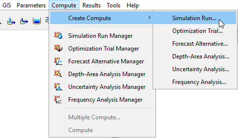
Step 13. Create a Simulation Run by choosing Compute menu, then Create Compute > Simulation Run.... Name the Simulation Run May 1996 Inverse Distance, select the May1996 Basin Model, select the May 1996 Inverse Distance Met Model, select the May 1996 Control Specification, then press Finish.


Step 14. From the Simulation Toolbar, select the May 1996 Inverse Distance run from the drop down menu, and press the Compute All Elements button to run the simulation.
![]()
Step 15. You can view the results by choosing the Results tab of the Watershed Explorer, expanding the Simulation Runs node of the tree, selecting the May 1996 Inverse Distance Simulation Run, and clicking on the elements below it. Precipitation values for each gage are weighted based on the distance the gage is from the node location.
Project Files
Download the final project files here:
Note: The final project file is the same for the Gage Weights Precipitation, Gridded Precipitation, and Inverse Distance Precipitation tutorials. If you are completing all three tutorials, the files only need to be downloaded once.
This tutorial concludes the Meteorologic Models for Historical Precipitation tutorial group.