Once a map layer is in the HEC-RTS framework the user can make adjustments to the layer. From the HEC-RTS main window (Figure 1.1), from the Maps menu, click Map Layers. The Map Layers dialog box (Figure 5.2) will open. Now the user can see which Map Window is currently active and what map layers are available in that map window. To change the color and the fill aspects of a map layer do the following:
- From the Map Layers tree (Figure 5.9), right click a map layer, depending on what type of map layer it is, the shortcut menu (Figure 5.14) will be different.
- For example, Figure 5.14 displays a shortcut menu that allows the user to expand/collapse the RussianSubbasins.shp leaf; move the shapefile to different positions in the tree (Move To Top/Move To Bottom, Move up/Move Down); show the legend of the shapefile; change the label of the shapefile; edit the properties of the shapefile; set/remove scale factors; copy the map layer to another location; and open the attribute table of the shapefile.
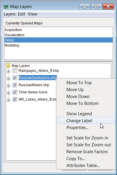
Figure 5.14 Map Layer – Shortcut Menu
- From the shortcut menu (Figure 5.14), click Properties, the Edit Polygon Properties dialog box will open (Figure 5.15). In the example (Figure 5.14), the RussianSubbasins.shp file is a polygon shapefile. To edit the fill of the active map layer, from the Fill tab, change the color or not have a fill. For the example in Figure 5.15, fill will be turned off. So click Display Fill, the check mark will clear, meaning that fill is turned off.
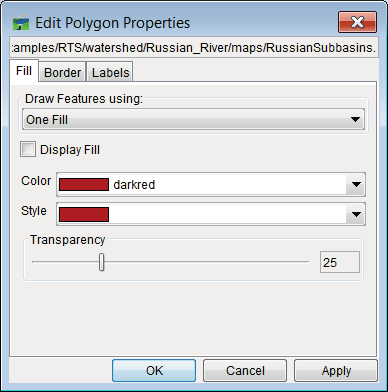
Figure 5.15 Edit Polygon Properties Dialog Box
- To turn off a map layer - click in the checkbox by Raingages_Albers_ft.shp, the rain gages no longer appear on the map window.
- To display the map window zoomed in, select the Zoom Tool
 . Draw a box around the map layers that are displayed in the Map Window. From the Maps menu, click Default Map Properties, the Default Map Properties for dialog box will open (Figure 5.16). Click Set Map Extents to Display, click OK. The Default Map Properties for dialog box will close.
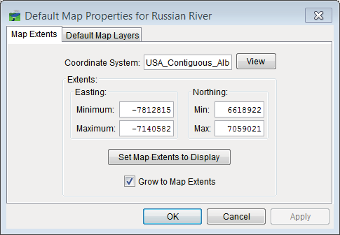
Figure 5.16 Default Map Properties for Dialog Box
This sets the extents for the Map Window so that when the study is opened the next time the
Map Window will be zoomed in to the tighter area.