Last Modified: 2024-10-28 10:37:39.946
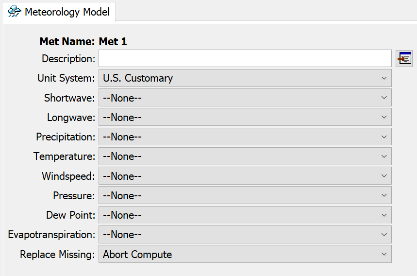
Within the Meteorologic Model of HEC-HMS are methods for modeling several aspects of atmospheric boundary conditions. The most important process for hydrologic modeling is precipitation. Precipitation determines how water enters the watershed being modeled. Below are the various processes contained in the met model:

Precipitation methods are broadly categorized into two types of methods: Hypothetical and Historical.
- Hypothetical methods are idealized representations of precipitation in time and space that are used for design and analysis. Examples include frequency storms and hypothetical storms, which are typically associated with a design return interval precipitation frequency event, or Hydrometeorological Report No. 52 (HMR 52) storms which are a representation of probable maximum precipitation. These precipitation methods do not represent storm events that have occurred, only events which have properties which are useful for design or analysis.
- Historical methods provide means for representing precipitation as it was observed. These methods can provide additional capability to describe rainfall in space and time. The most simple method is the specified hyetograph method, which provides a specific precipitation time series for each subbasin element in the watershed model. The next more complex methods are gage weights and inverse distance. These methods use precipitation stations and perform some level of averaging in space and time in order to describe the variability of precipitation. These methods compute the precipitation time series for each subbasin element instead of being provided directly. Finally, the gridded precipitation method uses a time series of grids that represent the variability of precipitation in space, generally on a sub-daily time step. Gridded methods are especially useful for modeling historical events when the precipitation was observed by radar or satellite, or modeled using reanalysis.
This tutorial will focus on the two most commonly-used methods for modeling historical precipitation: gage weights and gridded precipitation. A watershed model for Mahoning Creek above Punxsutawney, PA is provided below to get you started.

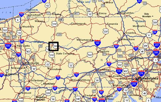
The Mahoning Creek watershed at Punxsutawney, PA is part of the Allegheny River Basin located in western Pennsylvania. The primary conveyance system of this 158 sq. mi. watershed includes the following streams: Stump Creek, East Branch Mahoning Creek, and Mahoning Creek. The confluence of Stump Creek and East Branch Mahoning Creek is located east of the enclave of Big Run. Mahoning Creek is downstream of the confluence. The rectangular box shows the study area.
Below are two guides that will step you through setting up meteorologic models necessary for performing a hydrologic simulation of historical events.
Gage Weights
Click here to access the tutorial for modeling historical precipitation using the gage weights precipitation method: Gage Weights Precipitation Method.
Gridded Precipitation
Click here to access the tutorial for modeling historical precipitation using the gridded precipitation method: Gridded Precipitation Method.
Additional Tasks
Click here to access the tutorial for modeling historical precipitation using the inverse distance precipitation method: Creating an Inverse Distance Precipitation Model.
Click here to access the tutorial for modeling historical precipitation using the interpolated precipitation method: Using a Single Gage within the Interpolated Grid Option
Continue to Gage Weights Precipitation Method.