Last Modified: 2024-05-17 13:50:24.781
Objectives
Gridded earth science data can be obtained from numerous sources. Earth science data is commonly distributed in NetCDF, HDF, GRIB, ASCII, and other raster formats. The primary input/output format of HEC programs is HEC-DSS. In this exercise you will use HEC-HMS data tools to download, import, and adjust precipitation and snow water equivalent (SWE) data for the Upper Truckee River watershed.
HEC-HMS incorporates Vortex which can also be downloaded as a standalone utility.
Tasks
This tutorial includes the following tasks:
Study Area
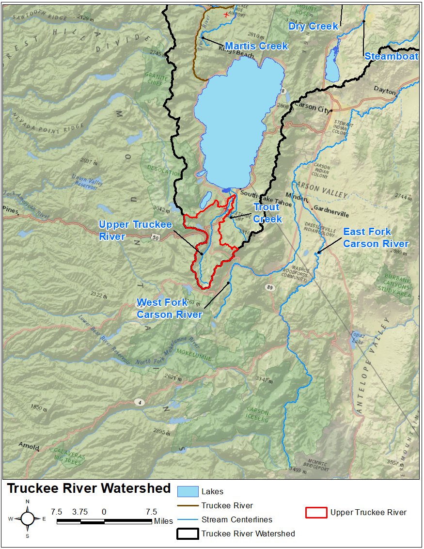
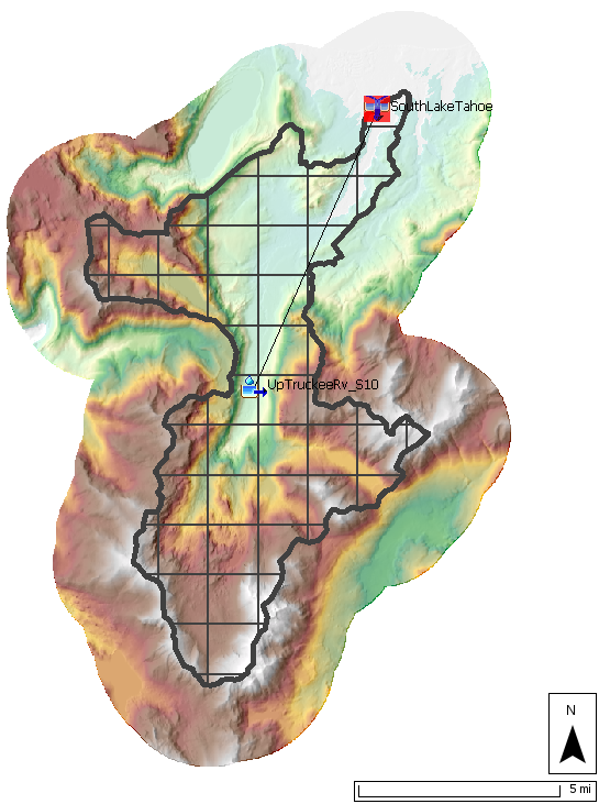
This workshop models the Upper Truckee River watershed upstream of the USGS stream gage at South Lake Tahoe, CA. The Upper Truckee River watershed encompasses an approximate 54 sq mi drainage area upstream of Lake Tahoe, as shown below. It is part of the larger Truckee River watershed. You can learn more about this watershed in the Introduction to Gridded Snowmelt Calibration workshop.
HEC-HMS Project
The Upper_Truckee_River project that is used in this example was extracted from a larger Truckee River HEC-HMS project that was developed as part of a research project that compared snow modeling methods: Temperature-Index (TI), Radiation-derived Temperature-Index (RTI), and Energy Balance (EB). In this example, the model consists of a single subbasin element that uses a 2000-meter SHG Structured discretization, the Simple canopy method, the ModClark unit hydrograph transform method, the Linear Reservoir baseflow method, and the Gridded Temperature Index snow method.
Project Files
Tasks 1-3 use the same project files. Task 4 uses the same project with a different configuration of basin models and simulation runs. Download new project files for task 4.
Continue to Task 1: Importing Gridded Data