Last Modified: 2024-05-15 16:11:46.375
HEC-HMS version 4.11-beta.10 was used to create this example. You can open the example project with HEC-HMS v4.11 or a newer version.
Project files
 Upper_Truckee_Gridded_initial.zip
Upper_Truckee_Gridded_final.zip
Objectives
Gridded earth science data can be obtained from numerous sources. Earth science data is commonly distributed in NetCDF, HDF, GRIB, ASCII, and other formats. The primary input/output format of HEC programs is HEC-DSS. In this exercise you will use HEC-HMS data tools to download and modify precipitation, temperature, and snow water equivalent (SWE) data for the Upper Truckee River watershed.
HEC-HMS incorporates Vortex which can also be downloaded as a standalone utility.
In Workshop 1, you will import and edit the gridded data, and apply it in a HEC-HMS model. In Workshop 2, you will use the HEC-HMS Grid To Point tool to calculate subbasin-averaged SWE from SWE grids, and the Normalizer tool to create a normalized precipitation grid that captures the temporal variability of one gridded dataset but the cumulative volume of another gridded dataset.
Tasks
This tutorial group includes the following components:
Study Area
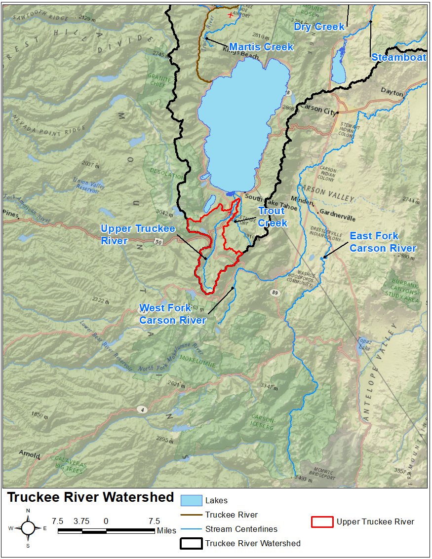
This workshop references the Upper Truckee River watershed upstream of the USGS stream gage at South Lake Tahoe, CA. The Upper Truckee River watershed encompasses an approximate 54 sq mi drainage area upstream of Lake Tahoe, as shown below. It is part of the larger Truckee River watershed. You can learn more about this watershed in the Introduction to Gridded Snowmelt Calibration workshop.
Review Existing HEC-HMS Project
You will use the HEC-HMS project named Upper_Truckee_River that was created for the Introduction to Gridded Snowmelt Calibration workshop. The initial project model for the two workshops in this exercise is attached in the Project Files section above. The HEC-HMS project contains a Basin Model named WY2017_TI, a Control Specifications named WY2017 and Feb2017, two Time Series, several Grid Sets, and a Terrain. As shown below, there is one subbasin element named UpTruckeeRv_S10 which is connected to a junction element named SouthLakeTahoe within the existing basin model. This subbasin was originally delineated using terrain data downloaded from the USGS National Map Viewer.
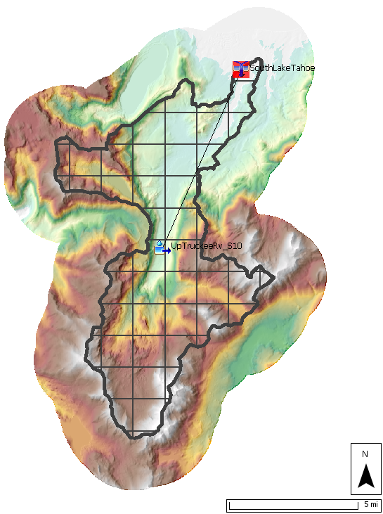
The subbasin element was configured to use a 2000-meter SHG Structured discretization, the Simple canopy method, the ModClark unit hydrograph transform method, the Linear Reservoir baseflow method and the Gridded Temperature snow method. The observed SWE and discharge time series were linked as observed time series to the subbasin and junction elements, respectively.
Continue to Part 1: Importing Gridded Data