Various types of input data are available for you in the Input directory for this workshop. Test any or all of the sample data (make sure to zoom out to the extent of the U.S.).
Adding Ascii Data.
Right-Click on the TIN node and click on "Select TIN files…"
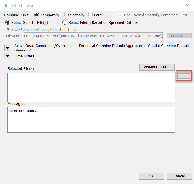
Open the browser window by first selecting the "…" icon in the "Select Data" dialog:
Browse to the Ascii directory (…\HEC-MetVue_Overview_Start\HEC-MetVue\Data\ascii\ESRI_ASCII\) and select the sample *.asc file.
When adding multiple ascii (or other compatible files) at once the target file extension (ex: *.asc) can be filtered within the file selection window by typing the file extension into the file name box and pressing enter:
Select "Ok" to close the "Select Files" dialog box and view the selected ascii data.
Copy & Rename the Map Window.
Map Windows can also be copied and renamed. Copying the map window copies all of its associated shapefiles and TIN data along with it. Creating a copy of the Map Window (vs. creating a completely new one) could be useful if you need to create a new Map Window with the same shapefiles (that are not already stored as Session defaults) or if you would like to manipulate (scale, rotate, translate, etc.) the data within a Copy of the original Map Window.
Copy the current Map Window by right-clicking on "TIN Data" → Map Window → Copy Map Window...
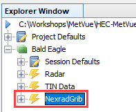
Name the new Map Window after the next type of data you'd like to load, for example, "NexradGrib."
Notice that a copy of the "TIN Data" map window has been created and renamed as "NexradGrib." The shapefiles and data from the "TIN Data" map window are present within the new Map Window.
Remove TIN Data.
Remove the ascii TIN data from the new map window by right-clicking on the data node in the Explorer Window tree and selecting Remove, or by opening the "Select TIN files…" editor and clearing the file reference in the Selected Files(s)" section.
Either remove via right-click from Explorer Window:
Or remove within the "Select TIN files…" editor:
Add New TIN Data.
Load the new TIN data (for example, NexradGrib) into the new map window using the same process described above.
Continue on to follow the same process to Select and Remove additional TIN files to inspect the other sample datasets provided in this workshop in the following file extensions: