Hyetographs to Scale (Shape Sets)
From the Hydrologic Sampling Editor, the Shape Sets tab allows the user to specify user-defined shape sets (time series), with DSS records for each hyetograph (subbasin) location that has been created in the Hyetograph Locations tab (refer to Hyetograph Locations for information on creating hyetograph location(s)). Each shape set must also have a weight for defining its relative likelihood among all shape sets, and a probability range within which it may be used.
A shape set is a collection of user-defined precipitation event hyetographs (time series) assigned to subbasin locations within a watershed. Shape sets are used to convert randomly sampled basin average precipitation depths into precipitation event hyetographs (time series). Each shape set inherently captures the temporal and spatial pattern of a particular precipitation event across a watershed, based on the occurrence of precipitation over time, and the relative magnitude of precipitation depth at various locations. Different shape sets will capture different examples of possible temporal and spatial patterns. A shape set inherently has no absolute magnitude, only relative magnitude between subbasin locations, and the set is scaled so the subbasin average (area-weighted average of all subbasin hyetographs) matches the randomly sampled precipitation depth of each precipitation event. A shape set will also have temperature time series if temperature locations are defined, which are used for the event as provided and not scaled.
When multiple hydrologic sampler watershed's are defined in the alternative, each with a set of subbasins and a basin-average precipitation frequency curve, each shape set will contain hyetographs for all the subbasins of all the watersheds. Computations done to scale a shape set to a randomly sampled basin-average precipitation depth are performed separately for each HS watershed, once the shape set is chosen.
Select Shape Set Time Series section provides more information regarding DSS time series, and includes examples of shape set hyetographs. It is important to note that the DSS time-window (start and end dates and times) of each hyetograph shape within all shape sets must be the same for all subbasin locations. In other words, the time series start and end dates and times must all agree in the selected DSS file(s) for all shape sets. Furthermore, the time interval (e.g., 15 minutes, one hour, one day, etc.) for all hyetographs in all shape sets must be the same.

Moreover, it is good practice for the duration of effective precipitation (non-zero precipitation) within the shape set to match the duration of the basin average precipitation frequency curve, or the longest duration if more than one duration and frequency curve is defined. For example, the hyetographs should have 72 hours of non-zero precipitation when the duration of the basin average precipitation frequency curve is three days. Having more or less than three days of non-zero precipitation will leave some time-periods unscaled, and will result in a total storm depth different from the value sampled (especially for smaller sampled events). However, the overall time-window of the hyetographs should extend beyond the duration of the basin average precipitation frequency curve to allow the subsequent rainfall-runoff model compute to capture all of the resulting runoff, which will extend beyond the end of precipitation.
Specifically, zero precipitation values can be added to the precipitation shape sets so computed runoff makes its way through the watershed (as required by subsequent models in the FRA compute sequence). For example, if an HEC-ResSim model requires a significantly long lookback period, each shape set should be defined with adequate time-steps (compute interval) for the lookback window before the start of the event. Refer to the HEC-WAT User's Manual or the HEC-ResSim User's Manual for more information on lookback periods.
Typically, actual (historical) precipitation events are chosen to define shape sets in the watershed, with the hyetograph for each subbasin location provided as it occurred. During the compute, the selected set of shapes is scaled to match the sampled basin average precipitation depths for each watershed for a randomly sampled precipitation event. Artificial shape sets, or hyetographs from some other watershed or model, may also be used to supplement historical events, if the historical events do not provide all desired time and space distributions. A good practice is to include hyetograph shape sets that represent many possible variations of precipitation across the watersheds in the study.
The Hydrologic Sampler generates flood events across the range of very large to very small, defined by the randomly sampled exceedance probabilities. Some event shapes are more appropriate for large events and some for small, and so an Exceedance probability filter is defined for each shape set to specify the range of event magnitudes for which the set is appropriate. The exceedance probability sampled for the flood event limits the available shape sets to only those having that probability in their allowable range.
The shape set's Weight (review Assign Shape Set Filters and Weights) defines the relative likelihood of each set (weight of set divided by sum of weights of available sets), used in randomly selecting a shape set for each event. The Shape Set Summary tab (refer to Limiting Precipitation Shape Sets by Exceedance Probability) shows the resulting relative likelihood for each range of exceedance probability, because likelihoods adjust for a range in which some sets are not available.
The structure of the Shape Sets tab consists of one main section, the Shape Set section, and three panels: (1) the exceedance probability filter panel for setting the exceedance probability filter maximum and minimum, (2) the weight panel to set the weight of the shape set and view the resulting total weight and probability, and (3) the DSS time series panel for setting the DSS record pathname for all hyetograph locations. Users create shape set(s) in the Shape Set section, and enter information specific to each created shape set in the three panels.
Create Shape Sets
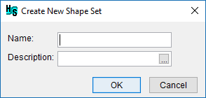
For each new shape set, the user will specify the shape set's Weight, Exceedance probability filter and a DSS record for each location in the DSS time series panel. To create a new shape set, from the Shape Set tab, click New Set, and the Create New Shape Set dialog box will open.

Enter a name for the new shape set in the Name box. Enter a description of the shape set in the Description box (optional, but recommended). Click ![]() , which opens the Enter Description window, which allows the user enter or view a length description. Click OK, the Create New Shape Set dialog box will close. The Hydrologic Sampling Editor updates with the created shape set.
, which opens the Enter Description window, which allows the user enter or view a length description. Click OK, the Create New Shape Set dialog box will close. The Hydrologic Sampling Editor updates with the created shape set.
Note
The Name (and description) can be used to match the correct DSS file (.dss) with the correct Shape Set when selecting the shape set from the DSS time series panel.

As described in the following sections, the users can continue to complete the created shape set by assigning the exceedance probability filters and weight, and by selecting the DSS shape set time series.
Assign Shape Set Filters and Weight
From the Shape Sets tab; users can continue to define a created shape set or edit an existing shape set (selected from the Shape Set list) by entering exceedance probability filters and a weight for the selected shape set, as follows:
- From the exceedance probability filter panel, the Location for Exc. Prob. filter (same for all shape sets) defines which sampled exceedance probability will be used in filtering when there is more than one watershed defined. The user may choose among the defined watershed with the dropdown field. When only one watershed has been defined (the default condition), it is the only dropdown choice and this step can be skipped.
- For individual shape sets, enter the Exceedance probability filters manually for Max and Min in the boxes provided, if the default values of 1.0 and 0.0 are not appropriate. To modify the defaults for the Exceedance Probability Max or Exceedance Probability Min for the shape set, click inside the box provided and manually change the number.
- The exceedance probability maximum and minimum values allow the user to define the appropriate probability range for each shape set, with the exceedance probability corresponding to the sampled precipitation depth. For example, some historical precipitation event shapes are reasonable only for a very large precipitation event (with small exceedance probability), and some are reasonable only for a smaller precipitation event (with large exceedance probability).
- By default, the Exceedance Probability Max is 1.0 and Exceedance Probability Min is 0.0. Use the default minimum and maximum, to allow the selected shape set to be chosen for any precipitation event.
- To limit a shape set to only large events (that correspond to small exceedance probabilities), assign the Exceedance Probability Max value a probability smaller than 1.0.
- To limit a shape set to only small events (that correspond to large exceedance probabilities), assign the Exceedance Probability Min value a probability larger than 0.0.
- For individual shape sets, click inside the box provided and manually enter the Weight for the selected shape set, if the default value of 1.0 is not appropriate. The purpose of the weight is to define the relative likelihood of sampling individual shape sets. One shape set may be unusual for the watershed, and another might be quite common. Therefore, users can assign each shape set a weight; based on that weight the probability is automatically generated. The probability is computed, as the shape set's weight divided by the sum of the weights of all relevant shape sets. Equal weights will result in individual shape sets having equal likelihood of being sampled, while shape sets with higher weights result in a greater likelihood of being sampled.
- By default, the Weight for a created shape set is a value of 1.0, which results in the shape set having equal likelihood of being sampled. For example, if a hydrologic sampling alternative contains three shape sets and each shape set has a Weight value of one, then each will have a one-third chance of being selected for each precipitation event (weight 1.0 divided by total weight 3.0).
- If one of the three shape sets has a Weight of 2.0, it will then have a probability of one-half of being chosen (weight 2.0 divided by total weight 4.0), and the other two shape sets will have a probability of one-quarter (weight 1.0 divided by total weight 4.0).
For convenience, users can view a list of all created and defined shape sets, with the exceedance probability bounds, the weight and resultant probability (full range) displayed for each shape set, from the Shape Set Summary tab (refer to Section 4.6).
Select Shape Set Time Series
A shape set is a collection of user-defined scalable hyetograph time series for every subbasin location that together capture the relative spatial and temporal distribution of rainfall throughout the watershed for a given event, which is usually defined by a large event from the historical record. Based on the user-defined area for each subbasin (refer to Hyetograph Locations), the shape set time series is used in conjunction with a randomly sampled basin average precipitation depth to create a hyetograph for every subbasin area. When multiple HS watersheds are defined, the subbasins in all watersheds are included in each shape set.
Several important aspects should be considered when defining the shape set hyetograph time series for each subbasin location. For example, the type of storm, the speed, and the direction it travels across the watershed often affects the duration of the resulting peak streamflow and relative timing of the peak flow at various locations in the watershed. Shape sets should capture the "critical" duration for the watershed, which reflects the duration of extreme precipitation events that have the greatest effect on the resulting peak streamflow, as well as any other duration found to be relevant. The duration of effective, non-zero precipitation in each shape set must match either the critical duration of the basin average precipitation frequency curve, or the longest duration if more than one are defined. Precipitation depths outside that window will not be scaled, and will affect the total precipitation depth of the sampled and scaled event.
Several historical flood events should be chosen that collectively capture an array of possible precipitation event patterns. The example plots provides two different example shape sets, each with three hyetographs from an historical precipitation event. The three individual hyetographs in each figure together form one shape set for a hydrologic sampling alternative that contains three hyetograph locations.
 and 1975 (right).")
Important: The DSS time-window (start and end dates and times) of each hyetograph shape must be the same for all subbasin locations within a shape set, but can be different between shape sets (e.g., Historical Precipitation Events for 1960 and 1975). However, the time interval (e.g., 15 minutes, 1 hour, 1day, etc.) and the number of event ordinates must be the same for all hyetographs in all shape sets.
Note
If an HEC-ResSim model requires a significantly long lookback period, each shape set should be defined with adequate time-steps (compute interval) for the lookback window before the start of the event. In other words, all hyetographs in the shape set must have a time-window appropriate for the HEC-ResSim model's lookback window. The example plot with added time-steps provides an example of three hyetographs in a shape set with added time-steps to extend the start of the time-window. Refer to the HEC-WAT User's Manual or the HEC-ResSim User's Manual for more information on lookback periods and time-steps.

Each individual hyetograph time series must be stored as a DSS record, most conveniently in the same HEC-DSS file (.dss). Refer to the HEC-DSSVue User's Manual for more information regarding HEC-DSS files. Users select the stored DSS records through the Hydrologic Sampling Editor interface, from the Shape Sets tab, which is then referenced by the Hydrologic Sampler during an FRA compute.
The next steps describe selecting the DSS record pathnames for time series for all hyetograph and temperature locations, from the DSS time series panel. A hyetograph must be defined for each subbasin hyetograph location (as defined in Hyetograph Locations) listed in the DSS input table, and a temperature time series for each temperature locations. DSS records must be specified for all created shape sets (as selected from the Shape Set list).
Complete the DSS input table for shape set locations:
For each hyetograph and temperature Location listed in the DSS input table, a DSS path must be identified (DSS File and pathname Parts A – F). To set the DSS path, click any cell in the row for the hyetograph location of interest, and the location-specific Select DSS Path button will be enabled.

Note
The time-step (or time interval) for the time series DSS records must be the same for all locations. In other words, Part E (e.g., 1HOUR) must be the same for all locations in all shape sets contained in the Shape Sets dropdown list. Similarly, the DSS record length (time-window: start and end dates and times) must be the same for every record in the shape set. All shape sets (contained in the Shape Sets list) must also have the same DSS record lengths, i.e., all must have the same number of ordinates.
- To select a DSS path for a location, click any cell in the row of a location; click Select DSS Path. An HEC-DSSVue dialog box will open. Refer to the HEC-DSSVue User's Manual for more information regarding DSS pathnames and HEC-DSSVue.

- From the HEC-DSSVue dialog box, click
 ; the Open HEC-DSS File browser will open. Browse to the location of a DSS file (*.dss) that contains the time series shape set hyetographs. Click on the appropriate .dss file, the File name box now contains the name of the selected file (e.g., 1986_Shape.dss).
- Click Open, the Open HEC-DSS File browser will close. The HEC-DSSVue dialog box now displays the DSS records for the selected DSS file.
- For the location (e.g., Brush Creek) that was selected in the DSS input table in the Hydrologic Sampling Editor, find and select the proper pathname (record) from the list of DSS records in the HEC-DSSVue dialog box, click Set Pathname. From the Hydrologic Sampling Editor, the DSS input table now contains the DSS File pathname (Parts A – F) for the selected Location (e.g., Brush Creek).
- Select the next location, from the HEC-DSSVue dialog box, find and select the proper pathname (record) from the list of DSS records in the HEC-DSSVue dialog box, click Set Pathname. Repeat this step until all locations in the DSS input table contain the correct DSS filename and the DSS pathnames.

- Click Apply. Next, the user can choose to define the DSS records for the other shape sets selected from the Shape Set list (and repeating Steps 1 through 6), move onto reviewing the shape sets and making adjustments, or click OK to save the selected hydrologic sampling alternative and close the Hydrologic Sampling Editor. Recall that Data Check (review Hydrologic Sampling Editor Interface) can be used to search for data consistency error(s) prior to closing the editor.
Rename a Shape Set
To rename an existing shape set selected from the Shape Set list, from the Shape Set main section, click the Rename Set button to open the Rename Shape Set dialog. Enter the new name for the shape set in the Name box and a description in the Description box (optional, but recommended). Click OK to save changes.

Copy a Shape Set
Copy a selected shape set, from the Shape Set main section, click Save Set As to open the Save Shape Set As dialog. Either use the default name or manually enter the name for the copied shape set in the Name box and a description in the Description box (optional, but recommended). Click OK to save changes.

Delete a Shape Set
To delete an existing shape set selected from the Shape Set list, from the Shape Set main section, click Delete Set to open the Confirm delete dialog. Click Yes to delete the selected shape set. Click No to close the Confirm delete dialog without deleting the shape set.
