Download PDF
Download page Delineating the Magat River Basin Model.
Delineating the Magat River Basin Model
Return to Generating a Flow Forecast for Magat River, Philippines
Last Modified: 2023-12-13 16:32:21.652
Software Version
HEC-HMS version 4.11 was used to create this tutorial. You will need to use HEC-HMS version 4.11, or newer, to open the project files.

Create the Terrain Data
NASA's Shuttle Radar Topography Mission (SRTM) data is a global digital elevation model (DEM) dataset and can be used to generate terrain data for HEC-HMS, for any location in the world. In this tutorial the terrain data has already been prepared for you (see srtm_filled.tif in the gis.zip file available at the top of this tutorial).
For more in depth coverage on preparing terrain data for HEC-HMS, see the following tutorials:
Create a New Project
- Open HEC-HMS.
- From the File menu, select New.
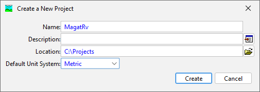
- In the Create a New Project Dialog, name the project MagatRv and set the default unit system to Metric.
- Click Create to create the project.
Add the Terrain Data
- From the Components menu, select Create Component | Terrain Data.
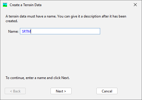
- In the Create a Terrain Data dialog, name the terrain SRTM. Select Next.
- In the Create a Terrain Dialog, set the path to the srtm.tif file. Set the vertical units to Meters. Select Next.
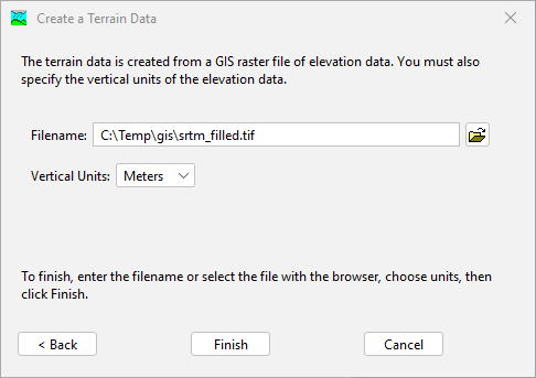
- Click Finish. The Terrain Data has now been created.
The path to terrain data specified above is located external to the project directory. Upon creation of the Terrain Data in HEC-HMS, a copy of the file will be created internal to the project directory.
Create a Basin Model
- From the Components menu, select Create Component | Basin Model.
- In the Create a New Basin Model dialog, name the basin model MagatRv.
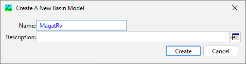
- Click Create. The Basin Model has now been created.
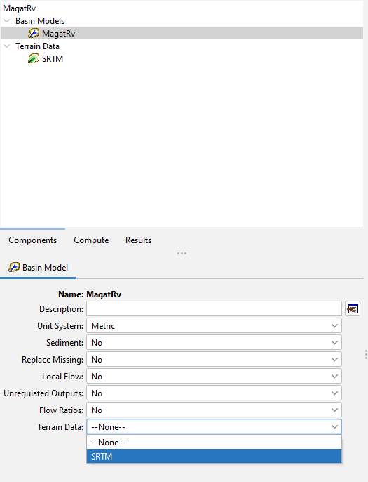
Link Terrain Data to the Basin Model
- In the Watershed Explorer, select the MagatRv basin model.
- In the Component Editor, set the Terrain Data to SRTM.
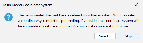
- Click the program Save button. You will be prompted to set the basin model coordinate system. In the Basin Model Coordinate System dialog, select Skip to adopt the coordinate system of the terrain data. The terrain data is in the UTM zone 51 North projection.
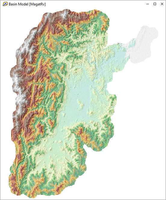
- The terrain data has now been linked to the basin model.
Prepare the Terrain Data
The Terrain Reconditioner in HEC-HMS prepares terrain data for hydrologic analysis by reinforcing flow lines and the watershed boundary.
For more in depth coverage of terrain reconditioning, see Applying the Terrain Reconditioning Tools.
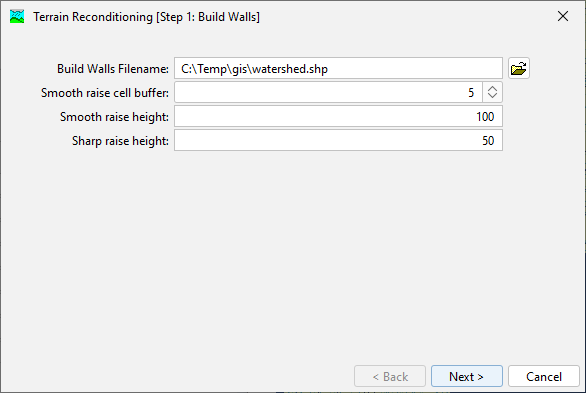
- From the GIS menu, open the Terrain Reconditioner.
- In Step 1, select watershed.shp as the build walls file name. Use smooth raise cell buffer: 5, smooth raise height: 100, and sharp raise height: 50.
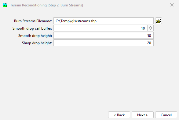
- In Step 2, select streams.shp as the burn streams file name. Use smooth drop cell buffer: 10, smooth drop height: 50, and sharp drop height: 20.
- Click Next. The reconditioned terrain has now been created and will be used in subsequent terrain processing steps.
Process the Terrain Data
- From the GIS menu, run the Preprocess Sinks command. This will fill in all local minima in the raster.
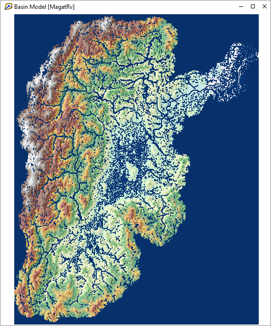
- From the GIS menu, run the Preprocess Drainage command. This will create flow direction and flow accumulation rasters that will be used in subsequent delineation steps.
- From the GIS menu, run the Identify Streams command. Set the area to define streams to 1000 KM2. This will create an identified stream raster.

Delineate the Basin
- From the GIS menu, select Breakpoint Manager.
- From the Break Points Manager, select Import.
- In the Break Points Importer dialog, specify the breakpoints.shp shapefile. Select the Snap breakpoints to identified streams option.

There should now be three breakpoints snapped to the identified streams layer. - From the GIS menu, run the Delineate Elements command.
- When prompted with Delineate Element Options, set Insert Junctions to Yes.
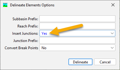
The basin has now been delineated with two subbasins, a junction, and a single reach.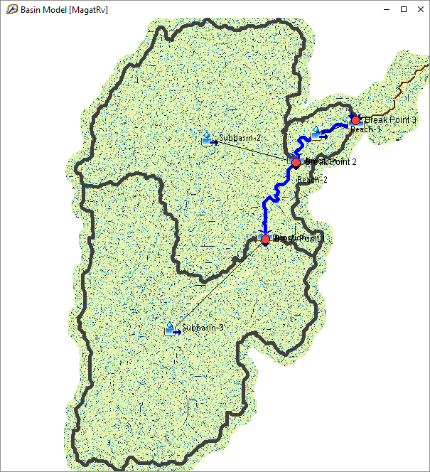
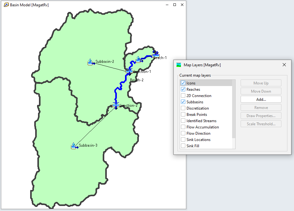
Once delineation is complete you can turn off terrain and terrain-derived map layers. From the View menu, select Map Layers. In the Map Layers dialog, toggle on or off map layers.
Summary
A basin model was delineated from terrain data and is now ready for parameterization.
Continue to Parameterizing the Magat River Basin Model