Download PDF
Download page v.4.12.0 Release Notes.
v.4.12.0 Release Notes
Initial beta release:
Final version release:
New Features
Improved Terrain Data Management
As of v4.12, terrain data is now managed such that there is only one copy of the terrain, and terrain-derived rasters, per terrain-projection combination. In previous versions, a copy of the terrain data, and terrain-derived rasters, was made for every basin model regardless of whether the terrain and projection were the same. This caused excessive project size on disk, most notably when many copies of the basin model were made, as is the case in forecasting.
The terrain and terrain-derived files are now located in <project directory>/terrain/<terrain name>/<projection index> location, unless an external reference is made. Pre-v4.12 projects will be automatically migrated, which moves the terrain file from <project directory>/terrain/<terrain name>.elevation.tif to the new terrain directory. Additionally, terrain-derived rasters are moved to the new terrain directory from the <project directory>/gis/<basin name> folder.
The <project directory>/terrain directory of an HEC-HMS project is managed by HEC-HMS. Manually manipulating the contents of this directory could corrupt the project and result in data loss or render the project unopenable.
As part of the terrain data management improvements, there is now an option to copy terrain data when using Project | Save As to create a copy of the project. If the copy terrain data option is selected, a copy of the terrain files will be made in the new project location. If the copy terrain data option is not selected, a reference will be made to the terrain files in the original project location.
This feature was funded by the Corps Water Management System (CWMS) National Implementation Program. Initial code and implementation was done by Tom Brauer. Testing was done by Matt Fleming, Mike Bartles, and Tom Brauer.
Improved Terrain Data Management when using CWMS/HEC-RTS
In previous versions of HEC-HMS, when extracting a "forecast" project from a "base" project within an CWMS/HEC-RTS watershed, all terrain data and terrain-derived data sets (e.g., flow direction, flow accumulation, etc.) were copied to the "forecast" project. Now, the "forecast" project will instead reference the "base" project's terrain data. This improvement will shorten the amount of time necessary to extract a new "forecast" project as well as save disk space.
This feature was funded by the Corps Water Management System (CWMS) National Implementation Program. Initial code and implementation was done by Mike Bartles and Tom Brauer. Testing was done by Matt Fleming, Mike Bartles, and Tom Brauer.
Storm Temporal Pattern and Area Reduction Function Sampling
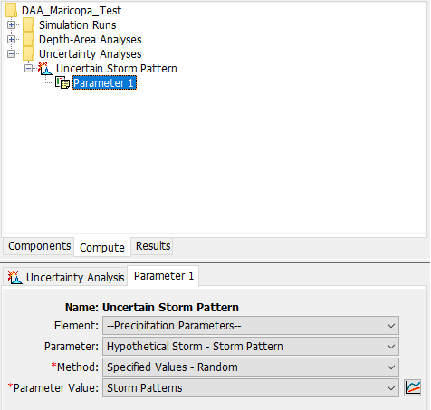
In v4.11, the ability to sample non-numeric parameters was added in the form of sampling precipitation gridsets. This concept has been extended in v4.12 to allow sampling of a hypothetical storm's storm pattern and area reduction function in the Uncertainty Analysis. A Parameter Value Samples paired data must be created that lists storm patterns or area reduction functions. The paired data must then be referenced as an Uncertainty Analysis parameter.
The image below shows the "Storm Patterns" Parameter Value Samples paired data selected in the Uncertainty Analysis component editor.
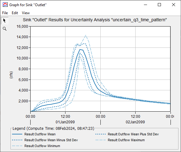
The image below shows the resulting hydrographs from randomly sampling the storm pattern.
This feature was funded by the USACE Flood & Coastal R&D Hypothetical Storms work unit. Initial code implementation was done by Thomas Brauer and Natasha Sokolovskaya. Testing was done by Greg Karlovits.
A tutorial and guide demonstrating the usage of depth-area reduction sampling within HEC-HMS can be found here: Sampling Depth-Area Reduction Curves for a Hypothetical Storm.
Ensemble Analysis Compatibility with Sediment Time-Series
In v4.11, the Ensemble Analysis compute type was created. In v4.12, the time-series types that are compatible with the Ensemble Analysis have been extended to include sediment load, sediment volume, and bulk flow. Total time-series are available for selection as well as individual grade time-series types.
This enhancement was funded by the SET program, and selected due to user feedback from a USACE CWMS wildfire workshop. Initial code implementation was done by Josh Willis. Testing was done by Dr. Jay Pak and Josh Willis.
Several tutorial and guides demonstrating the usage of the Ensemble Analysis within HEC-HMS can be found here: Using the Ensemble Analysis.
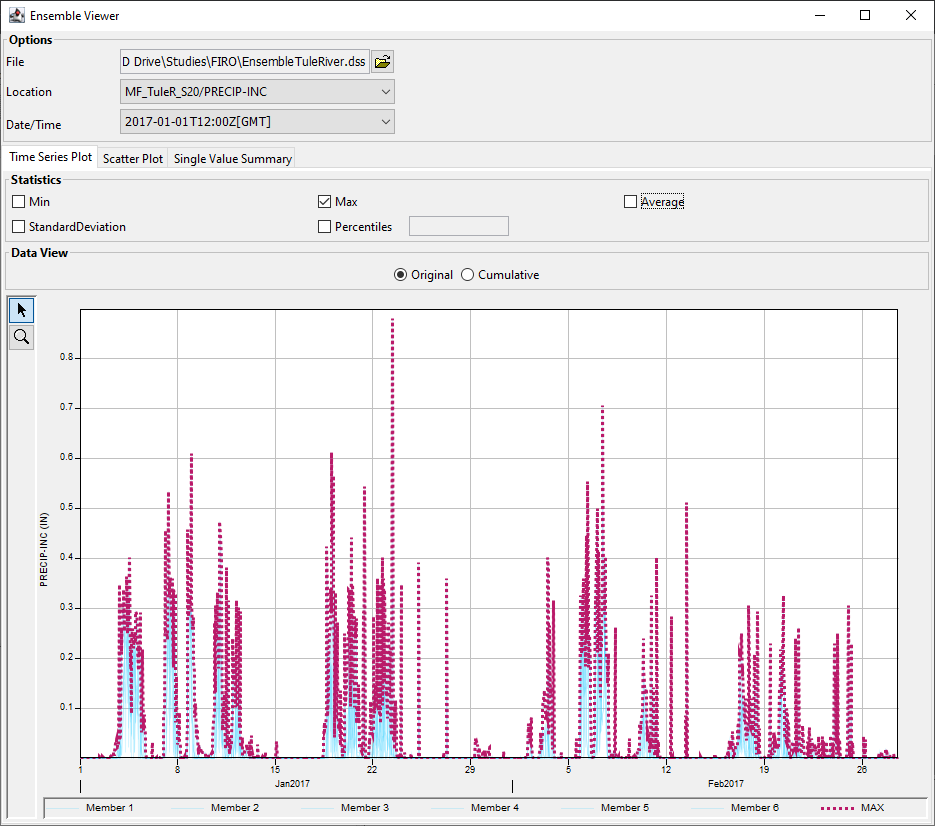
Ensemble Analysis Viewer
A Ensemble Analysis Viewer has been added to allow users to view ensembles computed in HEC-HMS and perform metric computes on the ensemble time-series. The ensemble viewer can compute metrics as a "Single Summary time-series", "Single Value for each Ensemble", or a Single Value Summary. The viewer can be accessed through the Tools | Ensemble Viewer. More information on the viewer is described here: Ensemble Viewer Users Guide.
This feature was funded by the FIRO program. Initial code implementation and documentation were done by David Ho. Review and testing were completed by Josh Willis and Tom Brauer.
Linear Deficit and Constant Loss Method
The Linear Deficit and Constant loss method is a modification of the initial constant loss method. This method accounts for changes in infiltration capacity (or potential infiltration rate) as a function of cumulative infiltration and can be applied as an event-based or continuous model. This new loss method will compute excess runoff even when the soil is not saturated if the precipitation intensity is large enough. More information can be found in the HEC-HMS Technical Reference Manual, Linear Deficit and Constant Model.
This feature was funded by the HH&C General Investigation Hydrologic Studies program. Algorithm development was completed by Dr. Gerhard Schoener, SSCAFCA Senior Hydrologist, code implementation was completed by Paul Ely, and documentation and testing were completed by Gerhard Schoener, Sara Rassa, Matt Fleming, Natasha Sokolovskaya, and Tamara Massong.
A tutorial and guide demonstrating the usage of the Linear and Constant loss method within HEC-HMS can be found here: Applying the Linear Deficit and Constant Loss Method.
Uncertainty Analysis method: Specified Values - Random (Same Index)
This new Uncertainty Analysis method combines the sampling methods of the Random and Specified Values methods. With this method, the sample index order will be random, based on the starting seed value, and all parameters using this sampling method will use the same index.
The original Specified Values method has been renamed to Specified Values - Random (Independently Random).
")
This feature was funded by the FEMA Future of Flood Risk Data initiative. Initial code implementation was completed by Daniel Black. Documentation and testing were completed by Daniel Black and Greg Karlovits.
Solar Shading Coefficient time-series and Spatial Results
Incoming shortwave (a.k.a. solar) radiation at a location can be reduced due to the surrounding terrain. These effects can lead to snow melting slower within shaded areas. While solar shading was included within previous versions of HEC-HMS, users can now visualize the computed solar shading coefficient as a subbasin-average time-series or as a spatial result (e.g., at each grid cell) when using either the Gridded Hybrid or Gridded Energy Budget snow methods, as shown below.

This feature was funded by the USACE Arid Regions R&D work unit. Initial code implementation was completed by Mike Bartles. Documentation and testing were completed by Mike Bartles and Avital Breverman.
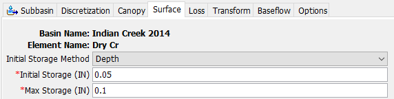
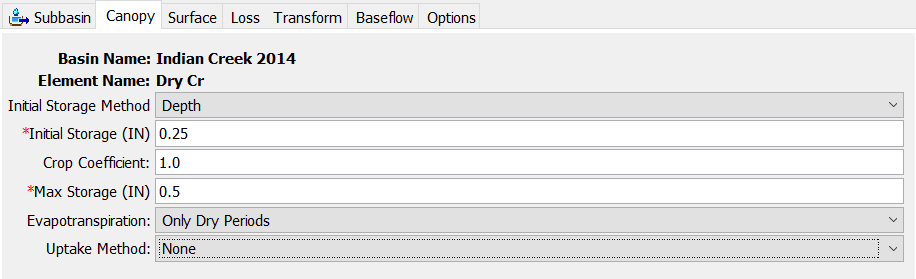
Simple Surface Initial Conditions Options
For the Simple Surface method, the initial state can now be defined both by the percent of the maximum storage that is filled, as well as by a depth of water.
This feature was funded by the FEMA Future of Flood Risk Data initiative. Initial code implementation was completed by Lauren Coe and Paul Ely. Documentation and testing were completed by Greg Karlovits.
Simple Canopy Initial Conditions Options
For the Simple Canopy method, the initial state can now be defined both by the percent of the maximum storage that is filled, as well as by a depth of water.
This feature was funded by the FEMA Future of Flood Risk Data initiative. Initial code implementation was completed by Lauren Coe and Paul Ely. Documentation was completed by Lauren Coe and testing was completed by Greg Karlovits.
Import Reach Routing Parameterizations from a Shapefile
GIS import tools were added to read-in reach routing attributes from shapefiles and automate the parameterization of Muskingum, Muskingum-Cunge, Normal Depth, and Kinematic Wave routing methods. If applicable, eight-point cross-sections are also automatically created from attribute information in the shapefile and used to parameterize the routing method. This feature was funded by Maricopa County. Initial code implementation was completed by Josh Willis. Documentation and testing were completed by Josh Willis.
A tutorial and guide demonstrating the parameterization of several reach routing methods via shapefile attributes can be found here: Applying the Maricopa County Parameter Estimation Tools.
Extend Results Output Interval to Include Weekly, Monthly, and Yearly Options
In previous versions of HEC-HMS, the results output interval could only be extended up to 24 hours within the output control dialog associated with the simulation. The output interval has now been extended to include weekly, monthly, and yearly output options.

Code implementation was completed by Josh Willis. Documentation and testing were completed by Josh Willis.
Hypothetical Storm Precipitation-Frequency Grid Selection Enabled with Area-Dependent Pattern Storm
In previous versions of HEC-HMS, if the Hypothetical Storm method chosen was the Area-Dependent Pattern, only the user-specified Point Depth option was available for precipitation. Now, users have the option of selecting the Precipitation-Frequency Grid precipitation method when using the Area-Dependent Pattern method. When using a precipitation-frequency grid, a computation point is specified and the average precipitation point depth upstream of the computation point is automatically calculated and applied during a simulation run.

This feature was funded by the Flood Control District of Maricopa County, AZ. Initial code implementation was completed by Josh Willis. Documentation and testing were completed by Matt Fleming, Greg Karlovits, and Josh Willis.
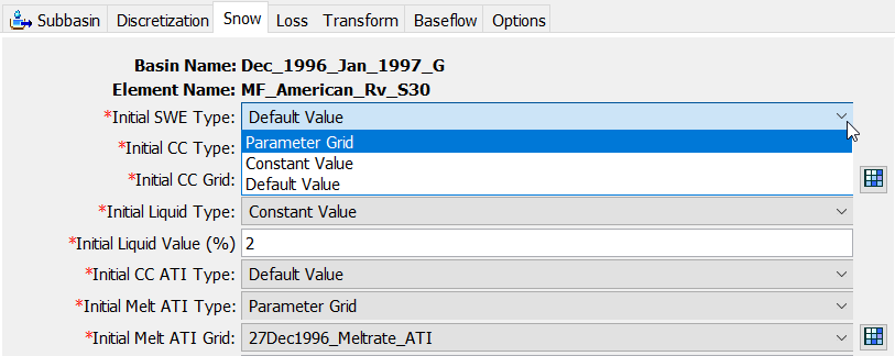
Additional State Initialization Options in Gridded Temperature Index Snow Method
Previously, the user could choose between "Parameter Grids" or "Default Values" for the initialization of Snow Water Equivalent, Cold Content, Liquid Water Content, Cold Content ATI and Meltrate ATI and a single initialization method was chosen for all five of the state variables. This update allows the user to choose a different initialization method for each of the state variables and a new option for a user-defined "Constant Value" is now available. This feature was funded by the Corps Water Management System (CWMS) National Implementation Program. Initial code and implementation were done by Lauren Coe and Tom Brauer. Documentation and testing were done by Lauren Coe.
MetSim Precipitation Method
This new meteorologic method, as implemented within HEC-HMS, follows that which is described in Bohn, et al (2019). This method interpolates sub-daily precipitation depths from an input daily precipitation accumulation grid through the use of an isosceles triangle shaped temporal distribution, which allows for more effective usage of daily meteorological boundary conditions when combined with sub-daily computational time steps. An example application of this method is shown in the following image. In this image, the input daily precipitation data (blue hyetograph) was disaggregated to an hourly time step (red hyetograph):

A tutorial demonstrating the usage of the MetSim Precipitation Method within HEC-HMS can be found here: Using the New MetSim Precipitation and Temperature Methods.
This feature was funded by the USACE Mississippi River Geomorphology & Potamology (MRGP) and General Investigations (GI) programs. Initial code implementation was completed by Mike Bartles, Dan Hamill, and Tom Brauer. Documentation and testing were completed by Mike Bartles, Dan Hamill, Paul Ely, and Tom Brauer.
MetSim Temperature Method
This new meteorologic method, as implemented within HEC-HMS, follows that which is described in Bohn, et al (2013). This method interpolates sub-daily air temperatures from input daily minimum and maximum air temperature grids through the use of a spline polynomial, as shown in the following image. In this image, the input daily minimum (black thermograph) and maximum (green thermograph) air temperature data was disaggregated to an hourly time step (blue thermograph). For comparison, the daily average air temperature (red thermograph) is also shown:

A tutorial demonstrating the usage of the MetSim Temperature Method within HEC-HMS can be found here: Using the New MetSim Precipitation and Temperature Methods.
This feature was funded by the USACE MRGP and GI programs. Initial code implementation was completed by Mike Bartles, Dan Hamill, and Tom Brauer. Documentation and testing were completed by Mike Bartles, Dan Hamill, Paul Ely, and Tom Brauer.
Transform Method Global Editor Improvements
Individual Clark Unit Hydrograph and User-Specified S-Graph sub-methods may now be selected from both the Transform Global Editor and Change Method Global Editor. Previously, these selections had to be made one at a time for each subbasin element via the component editor.
This feature was funded by Maricopa County. Initial code implementation and documentation were completed by Natasha Sokolovskaya. Review and Testing were completed by Tom Brauer and Josh Willis.
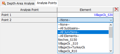
Depth-Area Analysis Enhancements for Adding and Removing Analysis Points
Instead of adding and removing depth-area analysis points one at a time, multiple points can be added at once by selecting "All Subbasins", "All Junctions", or "All Elements" options in the element combo box. Furthermore, multiple analysis points can be removed at once by clicking the red 'X' button after selecting multiple elements.
This feature was funded by Maricopa County. Initial code implementation was completed by Paul Ely. Review and Testing and Documentation were completed by Josh Willis.
Generalized Interoperability of Meteorologic and Basin Model Methods
In previous versions, a very limited number of lumped Meteorologic methods were allowed to be used with gridded Basin methods. For example, the Specified Hyetograph precipitation method was allowed to work with the ModClark transform method. However, other lumped meteorologic methods, like the Frequency Storm meteorologic method, was not allowed to be used with any gridded basin method. Now, nearly all Meteorologic methods are allowed to be used with nearly all Basin methods. Specific combinations of methods that are now allowed for use include (but aren't limited to):
- HMR52 Storm (meteorologic) and ModClark transform (basin)
- Frequency Storm (meteorologic) and Gridded Temperature Index snow (basin)
- Specified Thermograph (meteorologic) and Gridded Energy Budget snow (basin).
This feature was funded by the HH&C Science and Engineering Technology (SET) program. Initial code implementation was completed by Paul Ely. Testing was completed by Mike Bartles, Daniel Black, Avital Breverman, Lauren Coe, Melissa Mika, Natasha Sokolovskaya, and Josh Willis. Review was done by Tom Brauer.
Snow Covered Area time-series
A new Snow Covered Area time-series was added to the list of results that are available when one or more subbasin elements utilize a valid snow method. This time-series represents the portion (in percent) of each subbasin element(s) that is covered by a snow depth greater than 0. This time-series can be accessed via the Results menu. An example of the new time-series is shown in the following figure:

This feature was funded by the USACE Arid Regions R&D work unit. Initial code implementation was completed by Mike Bartles. Documentation and testing were completed by Mike Bartles and Tom Brauer.
Double-click for Tabular Cell Edit
When editing a data entry table, a double-click is now required to begin cell editing. In previous versions only a single-click was required to begin editing for cells that used a combo box or spinner box cell editor. This change in behavior was made to facilitate multiple cell selection with the mouse. In previous versions keyboard combinations had to be used to select multiple cells, e.g. Ctrl + Shift + Down and Ctrl + Shift + End.
This feature was funded by the HH&C Science and Engineering Technology (SET) program. Initial code implementation was completed by Tom Brauer. Testing and review were completed by Mike Bartles and Natasha Sokolovskaya.
ModClark Transform Variable Parameter Method
Variable Time of Concentration (Tc) and Watershed Storage Coefficient (R) relationships can now be utilized within the ModClark transform method. The Component Editor, when using the Variable Parameter method, is shown below.

This feature was funded by the FEMA Future of Flood Risk Data initiative. Initial code implementation for this feature was completed by Paul Ely. Documentation was completed by Mike Bartles. Testing and review were completed by Greg Karlovits and Tom Brauer.
Additional discussion regarding this method, including means by which Variable Tc and R relationships can be estimated for ungaged locations in California, can be found here: Bartles and Meyersohn (2023). A tutorial demonstrating the usage of Variable Tc and R relationships can be found here: Applying the Variable Clark Unit Hydrograph Method.
2D Diffusion Wave Transform Enhancements
Both the HEC-RAS and HEC-HMS teams make continual improvements to the shared 2D Solver, and this release contains the latest rollup of fixes and improvements. These changes were made to improve computational speed, stability, and accuracy of the 2D results. As such, you may notice subtle changes in hydraulic results, most notably to stage hydrographs. Please see the latest HEC-RAS v6.5 release notes for further details.
Initial code implementation and documentation for this feature were performed by Alejandro Sanchez, Nick Van, and Mike Bartles. Testing was completed by Nick Van and Mike Bartles.
These changes to the shared 2D Solver may lead to subtle changes in computed hydraulic results (most notably to stage hydrographs) when compared to previous versions.
Paste from Clipboard
Additional capability has been added to support paste from clipboard. Based on the program setting for decimal separator, HEC-HMS will attempt to remove non-decimal separator characters from the pasted string. For example:
- If the decimal separator is set to period, "1,234.56" would become "1234.56" after pasting
- If the decimal separator is set to comma, "1.234,56" would become "1234,56" after pasting
- If the decimal separator is set to comma, "1 234,56" would become "1234,56" after pasting
- If the decimal separator is set to period, " 1234.56" would become "1234.56" after pasting.
This feature was funded by the HH&C Science and Engineering Technology (SET) program. Initial code implementation and documentation for this feature were performed by Tom Brauer. Testing and review were done by Melissa Mika, Natasha Sokolovskaya, and Josh Willis.
Bugs Fixed
The following bugs were present in previous versions and have been fixed within version 4.12.
Editable Combo Box for Dynamic Surface Method
The combo box for the Dynamic Surface Global Editor was not editable by the user and the user could not switch from one method to the next. Dynamic Surface was added in v4.11. The issue has been fixed in v4.12-beta.1.
Occasional Aborted Computes when using the Energy Budget Snow Method
Simulations that used the Banded or Gridded Energy Budget Snow method would occasionally fail with a "WARNING 15303: Aborted run" message. This was only encountered when computing relatively long simulations (e.g., months to years) while also using a small results buffer length (e.g., 5000). This issue was introduced in v4.11-beta.14 and fixed in v4.12-beta.1.
Repetitive Warning Messages when using the Specified Barograph Atmospheric Pressure Method
Simulations that used the Specified Barograph Atmospheric Pressure method would produce repetitive "WARNING 12050: Unrecognized parameter in meteorologic model 'XYZ' messages". This issue was introduced in v4.11-beta.14 and fixed in v4.12-beta.1.
Incorrect Energy Budget Snow Computations during Cooling Periods following Melting
Inappropriate surface heat conduction equations were being used in the Energy Budget Snow method during cooling periods following melting when liquid water was present in the snowpack. This issue was introduced in v4.11-beta.1 and fixed in v4.12-beta.1.
This correction will change computed results during cooling periods following melting when liquid water is present in the snowpack.
Incorrect Computation of Refreezing Depth in Energy Budget Snow Method
Refreezing depth was incorrectly computed in the Energy Budget Snow method. This bug was introduced in v4.11-beta.1 and fixed in v4.12 beta.2.
This correction will change computed results in the Energy Budget Snow method.
Changes to Hybrid Snow Parameters Not Saved
Changes to Hybrid Snow parameters were not saved if the values were within a certain tolerance. The value and precision are compared to check for parameter changes. This issue was introduced in v4.11-beta.1 and fixed in v4.12-beta.1.
Aborted Compute in Reservoir Routing using Reservoir Volume Reduction
Sediment may be deposited above the spillway crest causing the compute to abort in certain cases. Changes were made to reduce the number of cases where the routing will fail. Additional work will need to be done to distribute deposited sediment when deposition is above the spillway crest elevation.
Broad-Crested Spillway Direction Reverted to Main when Saved
When using a Broad-Crested Spillway, the program would revert the Direction to Main when the save button was pressed. Users were unable to set a Broad-Crested Spillway as an auxiliary spillway. This issue was introduced in v4.11-beta.8 and fixed in the final release of v4.12.
MSDPM Debris Yield Produces Zero Sediment
Total precipitation for a debris yield event was set to zero preventing MSDPM from computing sediment yield. This error was introduced in v4.11- beta 14 and fixed in v4.12-beta 1.
Wrong Precipitation Units in Debris Yield Methods
If the meteorology model used US Customary units, the precipitation values passed to the debris yield methods were not correct. This was fixed in v4.12-beta 1.
Calculated debris yield was incorrect for any simulation using a meteorology model with US Customary units.
Pool Storage Below Lowest Value in Elevation-Storage Table
When using Rule-Based Operations routing, if the lowest elevation in an Elevation-Discharge table for a General Outlet is below the lowest elevation in the Elevation-Storage table an error may occur during the routing calculations.HEC-HMS was modified to require that the lowest elevation in an Elevation-Discharge table is not below the lowest elevation in the Elevation-Storage table. This requirement was added in v4.12-beta 1.
GIS | Compute | Create Grid Cell File Failed to Create a *.mod File
The GIS | Compute | Create Grid Cell File option fails to create a mod file. At the conclusion of the Create Grid Cell File wizard, the dialog closes and no mod file is created. This issue was introduced in v4.11 as part of a UI enhancement and fixed in v4.12-beta.1.
Errors When Importing a 2D Mesh Created in HEC-RAS v6.3.1
When importing 2D meshes created in HEC-RAS v6.3.1 (and newer versions), an "Error 17958: Unknown member name in compound dataset: 'Composite LC'" was thrown. This has been rectified such that 2D meshes containing a "Composite LC" attribute no longer cause errors when importing. This issue was introduced with the release of HEC-RAS v6.3.1 and fixed in HEC-HMS v4.12-beta.1.
Unspecified Error when Trying to Copy Subbasin with 2D Wave Transform
Subbasin with 2D Diffusion Wave transform should not be copied. Error message was added to prevent copying such subbasin to a clipboard.
Subbasin Characteristics Compute Failure with Undefined No-Data Value in Terrain Raster
When a basin model's linked terrain file contained an undefined no-data value, subbasin characteristics computations failed. This issue was likely introduced with the release of v4.7 and fixed in v4.12-beta.1.
Expression Calculator Compute Failure with Reach Characteristics
The expression calculator failed to compute a value when the expression was composed of reach characteristics. This issue was introduced in v4.10 and fixed in v4.12-beta.1.
HEC-HMS.cmd Launcher Failed to Launch with a Space in the Path
HEC-HMS.cmd failed to launch when the HEC-HMS distribution package was placed in a path that included spaces. This issue was introduced in v4.11 and fixed in v4.12-beta.1.
Gridded Precipitation Records Not Found when using more than One HEC-MetVue Alternative in an HEC-RTS/CAVI Forecast
When more than one HEC-MetVue alternative was used within a forecast created through HEC-RTS/CAVI, gridded precipitation records could not be found for the 2nd and all subsequent HEC-HMS alternatives. This issue was introduced in v4.9 and fixed in v4.12-beta.1.
Missing Spatial Results Records when Exported to DSS, GeoTIFF, or ASCII
When spatial results were exported to disk as either DSS, GeoTIFF, or ASCII grids, records would occasionally be missing. This issue was introduced in v4.11 and fixed in v4.12-beta.1.
Combined Inflows for Elements with no Upstream Connections
For most elements, combined inflows remained in the results tab when all upstream connections for the element had been removed. This issue was introduced prior to v4.4 and fixed in v4.12-beta.1.
Occasional Erroneous Air Temperature Spatial Results
Occasionally, erroneous air temperature spatial results were written to the HDF output file when using the Gridded Temperature Index, Gridded Hybrid, or Gridded Energy Budget snow methods. This issue was introduced in v4.11 and fixed in v4.12-beta.2.
X/Y Coordinate Units System for Gridded Precipitation Transposition
HEC-HMS v4.11 introduced gridded precipitation transposition. User-specified coordinates are provided that determine the transposition distances in both the X and Y directions. In v4.11 the X/Y coordinates were assumed to be in the projected units of the gridded precipitation data, regardless of the unit system of the meteorologic model, basin model, or the projected map units of the basin model. This assumption caused issues in the meteorologic model framework, most notably when viewing results or when changing the unit system of the meteorologic model. As of v4.12 the X/Y coordinates are assumed to be in the unit system of the meteorologic model, i.e., if the meteorologic model uses the Metric unit system, the X/Y coordinates should be specified in meters and if the meteorologic model uses the U.S. Customary unit system, the coordinates should be specified in feet, regardless of the projected units of the gridded precipitation data, the unit system of the basin model, or the projected map units of the basin model.
This modification will cause computed results to change for any case where the unit system of the projected units of the gridded precipitation data differed from the unit system of the meteorologic model. Users of the gridded precipitation transposition option in v4.11 should inspect their project to see if this condition exists when updating to v4.12. The migration path is to manually convert coordinate values from meters to feet or vice versa.
Sediment Compute Error when Direct Runoff Time-series is Unselected
Previously, when sediment is enabled within a basin model and the direct runoff time-series output was deselected from the simulation output control dialog, the simulation was aborted during compute with no meaningful error given. Now, if sediment is enabled, the direct runoff time-series becomes a required time-series and is unable to be deselected by the user. This issue was introduced in a previous release version and fixed in v4.12-beta.2.
Unavailable Sediment Time-Series Results not Greyed out in ResultsTree
Logic was previously added to HEC-HMS that greyed out time-series results nodes located in the results tree. However, this logic was not added for sediment results. Now, sediment time-series results nodes are correctly shown in a lighter grey font when they are unavailable for viewing. This issue was introduced in a previous release version and fixed in v4.12-beta.2.
Projects with many External Time-Series Gages Load Slowly
When projects contain many time-series gages (e.g., > 100), the linked external HEC-DSS files which contained the time-series were repeatedly queried to build a catalog of the records contained in each file. This issue is now rectified by using a cache of DSS catalogs.
This fix will result in drastically shortened project load times when using many external time-series gages.
This issue was likely introduced in a previous release version and fixed in v4.12-beta.3.
Export INST-VAL Spatial Results for a Single Time Step
In v4.11, when exporting a single time step of INST-VAL spatial results (e.g., snow water equivalent) to HEC-DSS, GeoTIFF, or ASCII, no file would be generated. This issue is now fixed and spatial results will be exported for the correct time step. This issue was introduced in v4.11 and fixed in v4.12-beta.3.
Account for Undefined Sediment Grain Size Distributions
In v4.11, when computing sediment/erosion, an exception could be triggered if an undefined grain size distribution was encountered. The issue is now fixed and both total sediment load and total sediment volume will be correctly written to disk. Grade loads are properly ignored in this scenario. The issue was introduced in v4.11 and fixed in v4.12-beta.3.
Interpolated Precipitation for Lumped Subbasins is Zero or Undefined when Recomputed
Precipitation was initially interpolated for a lumped subbasin, but precipitation was zero or undefined in subsequent runs. This issue was fixed in v4.12-beta.4.
None Discretization Incorrectly Reported as Invalid
In a compute where the basin model has both gridded and non-gridded methods and the meteorologic model has exclusively non-gridded methods, an error message 48000 could incorrectly be thrown indicating that the discretization file doesn't exist for the non-gridded subbasin. This was introduced in v4.7 and fixed in v4.12-beta.4.
A New Precipitation Gage Added to a Project is Automatically Added to Existing Inverse Distance Met Models
In previous versions, the action of adding a precipitation gage to an HEC-HMS project would automatically add the gage to any existing inverse distance meteorologic models in the project. The default behavior has now been changed so that the user has to explicitly toggle any added gages from "No" to "Yes" within the inverse distance component editor "Use Gage" column for them to be included. This default behavior was changed in v4.12-beta.4.
Add ATI-Meltrate Coefficient to Paired Data Snowmelt Selection
The ATI-Meltrate coefficient was not a selectable parameter for the Paired Data Parameter Value table and now is available. This issue was fixed within v4.12 beta.4.
Inconsistent Saving and Displaying Output Results for Uncertainty Analysis
When closing an HEC-HMS project that uses the Uncertainty Analysis compute with any timeseries results saved, after reopening the project and rerunning, the timeseries results are removed. This issue is now resolved in v4.12 beta.4.
Debris Flow Produces Zero Sediment when using ModClark Transform
HEC-HMS was not finding the precipitation time-series for a subbasin using ModClark transform when searching for debris flow events. This was fixed in v4.12-beta.4.
Failure for Watershed Explorer to Refresh after New Paired Data Added
If Paired Data did not previously exist in a project, the Watershed Explorer would fail to refresh after added new Paired Data to the project. The Paired Data would display in the Watershed Explorer after closing and re-opening the project in HEC-HMS. This issue was introduced in v4.10 and fixed in v4.12-beta.4.
Empty Groundmelt Rate Column in Global Editor
The Groundmelt Rate column in the Global Editor was not displaying the stored value upon first open of the Global Editor or when values were first entered into the Global editor. The issue was introduced in v4.12-beta 3 and fixed within v4.12-beta 5.
Incorrect Unit System when using Energy Grids
When using grids to initialize the snowpack energy content state variable within the Energy Balance snow method, the correct unit system was not being recognized. This issue was introduced in v4.11 and fixed within v4.12-beta.5.
Enable First Value Fill in File References Table
The Global File References table was added in v4.9. When initially implemented, the table did not allow tabular fill using the Repeat first value table fill option from the right-click Fill menu. The table functionality has been updated so that repeat first value fill is now enabled.
Right-click Fill Option does not work for Table Cells with Spinner Box
In tabular editors, the right-click fill, repeat first value option did not work in table cells that used a spinner box editor. This issue was introduced in v4.7 and fixed in v4.12-beta.5
Missing Flow when Forecast Time is at Beginning of Simulation
If the forecast time is the same as the simulation start time, the initial outflow was undefined resulting in erroneous values in the outflow time-series. This issue was fixed in v4.12-beta.5.
Undefined Error when Deleting a Basin from Met Model Manager
Removed undefined error message when a basin that is a part of a meteorological model is deleted in v.4.12-beta.5.
Missing Precipitation Time-Series Results after Computing a Depth-Area Analysis or Frequency Analysis
Fixed an error where precipitation time-series results nodes were greyed out (missing) after computing a depth-area analysis or a frequency analysis. This only occurred for gridded subbasin elements. This issue was introduced in v4.11 and fixed within v4.12-beta.5.
Optimization of Hybrid Snow Parameters Fails
There were two issues with optimization of Hybrid Snow parameters. First, the optimizer could not find the temperature grids. Second, the optimization would stop after one iteration and the parameters were the same as the initial values. These issues were fixed in v4.12-beta.6.
Unable to Save Manual Time-Series Data and Paired Data when using Comma Separator
Manually entered time-series data would revert to missing when using comma as the decimal separator. This issue was introduced in v4.10 and fixed in v.4.12-beta.6.
Simulation Compute Error with Depth-Area Analysis and Constant Monthly Baseflow
In previous versions, an ERROR 10000 would occur when computing a Depth-Area Analysis tied to a basin model that used the Constant Monthly baseflow method. A fix was made to allow the simulation to successfully compute to completion. This issue was introduced in v4.10 or prior and was fixed in v4.12-beta.6.
Incorrect Domain for HRRR Dataset in Automated Forecast
The domain specification for the HRRR data source was incorrect and allowed the HRRR data source to be selected for areas outside of the HRRR domain in some cases. This issue has been present since the initial implementation of the Automated Forecast in v4.9 and has been fixed in v4.12-beta.6.
Automated Forecast Failure when Empty Dataset is Encountered
When a dataset was retrieved that included no valid data the Automated Forecast would fail abruptly after retrieving the data. This is a previously unencountered condition that showed up in RTMA precipitation data. The code has been modified to proceed without the missing data. This issue has been present since the initial implementation of the Automated Forecast in v4.9 and has been fixed in v4.12-beta.6.
Generic Error in Uncertainty Parameter when Renaming Paired Data
Renaming paired data sometimes caused a generic error (ERROR 10000) in models that also had an uncertainty compute. The error has been present since 4.11 and was fixed in 4.12-beta.6.
User Adjustments to the Hypothetical Storm Area-Dependent Pattern table were not Tracked
When the user adjusted entries to the Hypothetical Storm Area-Dependent Pattern table by modifying either the area column or the pattern column, the changes were not tracked by the meteorologic model. During a regular, unforced simulation compute, any open results plots or tables would not correctly update based on the new user entries. This issue has likely been present since the initial implementation of the Hypothetical Storm Area-Dependent Pattern option in v4.4.0 and has been fixed in v4.12-beta.6.
Changes to the Snow Method were not Updated in the Uncertainty Analysis Parameter Options
Switching between lumped and gridded snow methods occasionally caused errors in models that also had an uncertainty compute. This issue was fixed in 4.12-beta.6.
Closing and Reopening HEC-HMS User Interface in CAVI/HEC-WAT Results in Incorrect Behavior
In previous versions, when the HEC-HMS user interface was opened and then subsequently closed through CAVI/HEC-WAT, incorrect behaviors were exhibited. These behaviors included the inability to display results from the map, interactively select/edit elements through the Edit menu, and reopen the currently selected Basin Model, amongst others. This issue has been rectified and the user interface behaves as expected when closing and reopening HEC-HMS. This issue was fixed in v4.12 beta.6.
Gridded Storm Optimization Results Mismatch with Objective and Variable Evaluation Values
For gridded storm optimization with an Optimization Trial compute, objective evaluation values (i.e. peak flow) and variable evaluation values (i.e. x and y locations) were sometimes written to DSS at incorrect indices causing a mismatch between storm location and peak flow results for an evaluation. This error was introduced in v4.11 and fixed in v4.12 beta.6.
Ensemble Compute Stalls after Deletion or Rename of a Basin Element
In v4.11, if a given time-series was selected in the ensemble analysis output control dialog and then the corresponding element was deleted or renamed in the basin model, any subsequent computes of the ensemble analysis could stall. Now, if a basin model element is deleted or renamed and it is tied to an ensemble analysis, any related and previously selected time-series results in the ensemble analysis output control dialog are automatically removed. This compute error was introduced in v4.11 and fixed in v4.12 beta.6.
Unable to Edit the Members of a Copied Ensemble Analysis
In v4.11, if an ensemble analysis was copied, any subsequent changes to the ensemble members (i.e. addition or removal) of the copied analysis would not properly save in some scenarios. This error was introduced in v4.11 and fixed in v4.12 beta.6.
Copying Snowmelt State Initialization Grids Returns Error
Copying snowmelt state initialization grids returns ERROR 10000. The issue was introduced in v4.12-beta 3 and fixed within v4.12-beta 6.
Reservoir Editor Panel does not Refresh
In v4.11, the Reservoir Editor Panel was not refreshing when a new routing method was selected from the drop down. The user had to click away from the reservoir element and then re-select it in order for the panel to update. The error was introduced in v4.11 and fixed in v4.12 beta 6.
Time-Series Table not Displayed when Observed Flow Data is Missing
There was an error that caused the Time-Series Table to not be displayed when observed flow data was missing. This was fixed in v4.12 beta 6.
Forecast Fails when Computing a Second Forecast in the CAVI
After computing a forecast, a second forecast would abort because the grid size in the second forecast was greater than the grid size used in the first forecast. The grid source location is compared with the gid in memory, and the grid size is reset if the locations are not the same. Fixed in v4.12 beta 6.
Forecast Compute Time Increases after Multiple Computes in CAVI
When making multiple computes of a forecast from the CAVI the compute time would increase with each compute. The number of messages sent back to the CAVI during a forecast compute was increasing with each compute. The number of messages was reduced to one for each compute step. Fixed in v4.12 beta 6.
CAVI Skips HEC-HMS Forecast Compute after HEC-HMS Parameters are Modified
HEC-HMS was not keeping track of when some forecast parameter adjustments had been modified. The code was updated soHEC-HMS keeps track of when a parameter adjustment is made. Also, the forecast alternative was modified to check if the basin model had been modified since the last compute. Fixed in v4.12 beta 6.
HEC-HMS Failed to Copy DSS Data when Creating a Forecast in CAVI
HEC-HMS would not copy DSS data from the base directory to the forecast directory. This was fixed in v4.12 beta 6.
Negative and Undefined Precipitation Values in Spatial Results
When a gridded precipitation data set with negative or undefined values was applied to a Basin Model, inconsistent spatial and time-series results were produced. In particular, the negative or undefined precipitation values were present in the spatial results (e.g. Incremental Precipitation and Cumulative Precipitation) but were filtered from the time-series results. Negative and undefined precipitation values are now filtered from the computations and results and a warning alerting the user is displayed in the Message Log. This issue was introduced in v4.7 and fixed in v4.12 beta 6.
Deletion of a Basin Model tied to an Ensemble Analysis could cause User Interface Errors
In some cases, the deletion of a basin model could incorrectly cause the "Analysis Type" selectable options in the ensemble analysis editor panel to be blank. This could, in turn, cause the ensemble members table to be blank. These issues were introduced in v4.11 and fixed in v4.12 beta 6.
Integer Parameter Types Reported as Floating Point in Univariate Searcher Results
In the univariate search method of the Optimization Trial, integer parameters, i.e. number of reservoirs, were incorrectly reported as floating point values in the optimization trial results. It is unknown when this issue was introduced. This issue was fixed in the final release of v4.12.
Surface ET is now Allowed to Occur during Periods of Rainfall
Previously, surface evapotranspiration was not allowed to occur during periods of rainfall even if the "Wet and Dry Periods" option was selected in the canopy method. Surface evapotranspiration is now allowed to occur during periods of rainfall starting in v4.12.
This modification will cause computed results to change when compared to previous versions IF a surface method is used in conjunction with a canopy method and the "Wet and Dry Periods" option is selected.
Plot not Updated when Simulation is Computed with Modified Parameter Values
Plots were not updating for simulations using interpolated air temperature and a fixed lapse rate. This issue was fixed in the final release of v4.12.
Use of a Lumped Subbasin with Gridded Meteorologic Methods caused Errors
When a compute was attempted that used at least one lumped subbasin and the Gridded Dew Point, Gridded Humidity, Gridded Pressure, Gridded Longwave, and/or Gridded Windspeed meteorologic methods, an error was thrown. This issue was introduced in v4.11 and fixed in the final release of v4.12.
Missing Values Sometimes Present in Spatial Results Exports
Certain basin model configurations, such as having a mixture of lumped and gridded subbasins, would sometimes result in missing values when exporting spatial results. This issue was introduced in v4.10 and fixed in the final release of v4.12.
Gridded Penman Monteith Errors when using a Simulation Time Step Longer than 1 Hour
The Gridded Penman Monteith method would result in erroneous evapotranspiration values when a simulation time step longer than 1 hour was used. This issue was fixed in the final release of v4.12.
Gage Temperature at a Daily Time Step Computes Invalid Daily Average, Minimum, and Maximum Values
The gage temperature method computed invalid daily average, minimum, and maximum values when the time step of the data was daily. This issue was fixed in the final release of v4.12.
2D Connection Flows were not always Computed for the Initial Time Step with the Diffusion Wave Transform
Flows and stage were not computed for 2D Connections in the Diffusion Wave transform in certain situations (when Use Warm up Period option was set to No). This issue was fixed in the final release of v4.12.
Incorrect Subbasin Editor Panel UI render when Switching Between Deg/Min/Sec and Decimal Dec via Program Settings
UI failed to render correctly for the subbasin editor panel when longitude and latitude switched between Deg/Min/Sec and Decimal Dec via Program Settings. This issue was fixed in the final release of v4.12.
Incorrect Solar Radiation Calculations using FAO56 Shortwave Method
FAO56 shortwave radiation method was not using sunshine hours in its calculations resulting in incorrect values for solar radiation. This issue was fixed in the final release of v4.12.
This change results in significant difference in calculated solar radiation.
Change in Subbasin Discretization and Snow Methods from the Global Editor was not Reflected in the Subbasin Editor
When the user made changes to subbasin discretization or snow methods via the Global Editor, those changes were not captured in the subbasin Component Editors. This issue was fixed in the final release of 4.12.
Hypothetical Precipitation Editor for Area-Dependent Pattern Storm Type was Missing an Area Entry Field
The area entry field was not added to the hypothetical storm editor for Area-Dependent Patterns storm type if area reduction was set to None. This was present as early as 4.10 and was fixed in the final release of 4.12.
Track Rename, Delete, and Unit System Changes in the Subbasin and Reach Characteristics
In the subbasin and reach characteristics tables that are accessed from the Parameters | Characteristics menu, fixes were made so that the tables properly track with element renames and deletions, and changes to the basin model unit system. These issues have been present since basin characteristics compute was introduced in v4.7 and fixed in the final release of v4.12.
Handle Daily Time Step Solar Radiation Data
If a solar radiation gage used a daily time step, daily maximum calculations were invalid. The only process known to use daily maximum solar radiation as of the v4.12 release is RTI snowmelt. This issue has been present since the introduction of RTI snowmelt in v4.11 and fixed in the final release of v4.12.
Filter Non-decimal Separator when Pasting into a Parameter Value Sample Paired Data Table
When values are copied and pasted into a paired data table, the non-decimal separator character, i.e. "." or ",", was not filtered out of the text prior to paste with the net result being that the values failed to paste. This has been present since the parameter value sample paired data type was introduced in v4.3 and fixed in the final release of v4.12.
Wind Speed Units Conversion Issue when using a Gridded Model
Specified Anemograph used in combination with a discretized subbasin would result in invalid wind speed data. This was fixed in the final release of 4.12.
This modification will cause computed results to change when compared to previous versions if the "Specified Anemograph" wind speed method is used in conjunction with a discretized subbasin for the Penman Monteith evapotranspiration methods and for the Energy Budget snowmelt methods.
Synchronize Changes between Discretization Component Editor and Global Editor
When both the discretization global editor and component editor were in view, changes in the component editor did not update the global editor and vice versa. This issue has been present since discretization global editors were introduced in v4.10 and fixed in the final release of v4.12.
Manual Entry Time-Series Editor Notes Missing Value for First Period
When manually entering data for a time-series gage of period values (i.e. not instantaneous), a note was incorrectly presented indicating a missing value corresponding to the first value of the time-series, which for period data, is empty. This was fixed in the final release of v4.12.
Remove Discretization when Switching from Structured to None
When changing the discretization method from structured to none, then recomputing grid cells with GIS | Compute Grid Cells, the structured discretization grid cells were not cleared from the GIS database and were not cleared from the graphical representation of the discretization in the Basin Map. This issue has been present since discretizations were introduced in v4.7 and fixed in the final release of v4.12.
Handle External HEC-DSS Parameter Value Samples
For externally referenced HEC-DSS parameter value samples, read units from the HEC-DSS record. Allow HEC-DSS pathnames with blank A, B, and F parts. This issue was introduced with the parameter value sample improvements in v4.12 and fixed in the final release of v4.12.
For Gage Meteorology Treat "--None--" Gage Selection as No Gage Selected
For gage meteorologic methods, if gage selection was --None-- this was treated as a gage named "--None--" rather than no gage selected. This resulted in incorrect error messages at simulation time. This issue was introduced in v4.10 and fixed in the final release of v4.12.
Interpolated Meteorology Data for Lumped Subbasins is Undefined when Recomputed
Interpolated temperature, pressure, dew point, humidity, radiation, or wind speed is undefined when a simulation is recomputed. Undefined values for most of these will cause the simulation to stop. This error was fixed in the final release of v4.12.
Ignore Data Quality when Computing Observed Flow
If observed time-series data included data quality flags indicating missing data the observed time-series would not interpolate between missing values and would include missing values. A change in behavior was made to ignore data quality flags when computing the interpolated observed time-series. This issue was fixed in the final release of v4.12.
Handle Comma Decimal Separator in Parameter Value Samples Data Entry
If the decimal separator program setting was set to comma numeric input for parameter value samples would not save. This issue was introduced in v4.11 and fixed in the final release of v4.12.
Fix Error 10000 when Saving Subbasin Editor Panel with 2D Diffusion Wave Transform Selected
Saving Subbasin Editor Panel with 2D Diffusion Wave transform option sometimes lead to unspecified errors. This was introduced in v4.11 and fixed in the final release of 4.12 by adding checks and error messages at runtime.
Allow File Specified Discretization to Work with 2D Diffusion Wave Transform
Previously File Specified Discretization would not work with 2D Diffusion Wave transform. This has been corrected and a user-specified *.hdf referenced in File Specified Discretization Panel will now function with 2D Diffusion wave, although the preferred method is still importing a HEC-RAS HDF file vie the File | Import menu. This was fixed in the final release of 4.12.
Subbasin Split Triggers Obfuscated Error Dialog and Deletes Subbasin
When splitting subbasins, in cases where flow paths converged in close proximity to the outlet an error could occur where an obfuscated error dialog was presented to the user. After accepting the error, the net result of the error was the subbasin intended to be split was deleted with no new subbasins generated. This error was observed in an urban/suburban terrain data with engineered stormwater systems. The issue was introduced in v4.9 and fixed in the final release of v4.12.
Store User Selection for not Inserting Junctions
When delineating a basin, the user is presented with several delineation options including an option to insert junctions. The "Yes" selection was stored but the "No" selection was not. If "No" was selected junctions would still be inserted on subbasin split. This issue was introduced in v4.4 and fixed in the final release of v4.12.
Gridded Precipitation bias correction option generates invalid precipitation when source grids have no data
When transposing gridded precipitation using the bias correction option, if the precipitation gridset being transposed included no data values, abnormally high precipitation could be generated during bias correction. The value of the no data value was not being defined on read and propagated through the calculations. This issue was introduced in v4.11 and fixed in the final release of v4.12.
This correction will change computed results for v4.11 models that used Gridded Precipitation transposition with the bias correction option with Precipitation gridsets that included a no data value.
Beta Releases
The following table presents features that were added and bugs that were fixed within each beta release. Only bugs that were introduced and fixed during the v4.12 development cycle are listed here.
| Release | Date | Features | Bug Fixes |
|---|---|---|---|
| beta.1 |
|
|
|
| beta.2 |
|
| |
| beta.3 |
|
|
|
| beta.4 |
|
|
|
| beta.5 |
|
| |
| beta.6 |
|
| |
| Final Release |
|
|
|