NOTICE: As of the release of HEC-HMS version 4.8 in April 2021, there is no longer a requirement that modelers use HEC-GeoHMS to delineate elements for an HEC-HMS project. HEC-HMS includes
GIS tools that allow modelers to delineate elements, define a discretization, compute subbasin and reach characteristics, and estimate model parameters. The HEC-HMS team is no longer investing resources
in developing, testing, and supporting HEC-GeoHMS. Instead, effort will continue be directed at improving and adding GIS capabilities directly to the HEC-HMS software. You can read about the HEC-HMS GIS
tools here, https://www.hec.usace.army.mil/confluence/hmsdocs/hmsum/latest/geographic-information.
Workshops with example datasets can be found here, https://www.hec.usace.army.mil/confluence/pages/viewpage.action?pageId=42175930.
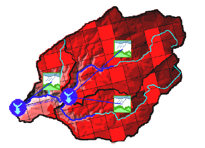 The Geospatial Hydrologic Modeling Extension (HEC-GeoHMS) has been developed as a geospatial hydrology toolkit for
engineers and hydrologists with limited GIS experience. HEC-GeoHMS uses ArcGIS and the Spatial Analyst extension to develop a number of hydrologic modeling inputs for the Hydrologic Engineering Center's
Hydrologic Modeling System, HEC-HMS. ArcGIS and its Spatial Analyst extension are available from the Environmental Systems Research Institute, Inc. (ESRI). Analyzing digital terrain data, HEC-GeoHMS transforms
the drainage paths and watershed boundaries into a hydrologic data structure that represents the drainage network. The program allows users to visualize spatial information, document watershed characteristics,
perform spatial analysis, and delineate subbasins and streams. Working with HEC-GeoHMS through its interfaces, menus, tools, buttons, and context-sensitive online help allows the user to expediently create
hydrologic inputs for HEC-HMS.
The Geospatial Hydrologic Modeling Extension (HEC-GeoHMS) has been developed as a geospatial hydrology toolkit for
engineers and hydrologists with limited GIS experience. HEC-GeoHMS uses ArcGIS and the Spatial Analyst extension to develop a number of hydrologic modeling inputs for the Hydrologic Engineering Center's
Hydrologic Modeling System, HEC-HMS. ArcGIS and its Spatial Analyst extension are available from the Environmental Systems Research Institute, Inc. (ESRI). Analyzing digital terrain data, HEC-GeoHMS transforms
the drainage paths and watershed boundaries into a hydrologic data structure that represents the drainage network. The program allows users to visualize spatial information, document watershed characteristics,
perform spatial analysis, and delineate subbasins and streams. Working with HEC-GeoHMS through its interfaces, menus, tools, buttons, and context-sensitive online help allows the user to expediently create
hydrologic inputs for HEC-HMS.