Riparian Vegetation Simulation Module (RVSM)
The Riparian Vegetation Simulation Module (RVSM) simulates the lifecycle of vegetation, including seed dispersal, seedling establishment, and plant growth and mortality in response to dynamic physical conditions.
RVSM is being linked with HEC-RAS to create a tools that will support feasibility studies for Flood Risk Management (FRM) and Ecosystem Restoration (ER) projects by addressing the following questions:
- What impact does riparian vegetation have on local flood conditions?
- What set of riverine operations can be used to encourage recruitment and survival of native vegetation (and control the spread of invasive species)?
- How will management actions impact habitat for endangered and threatened species?
Eleven vegetation roughness computation methods were included in RVSM. They are n-UR curves, Kouwen and Li (1980), Huthoff et al. (2007), Cheng (2011), Baptist et al. (2007), Järvelä (2004), Freeman et al. (2000),
Fischenich (2000), Kouwen and Fathi-Moghadam (2000), Luhar and Nepf (2013), and Whittaker et al. (2015). RVSM can be used to compute dynamic roughness coefficients for the unsteady flow model and assist in the flow
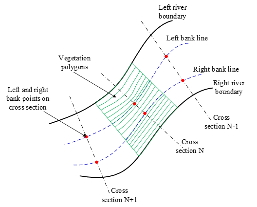
model calibration. The riparian zone needs to be discretized into a vegetation computation mesh, including an array of parallel slice polygons along the channel bank.
Model results can be used for environmental impact statement (EIS) and habitat studies, to support predictions of future physical conditions, and to inform alternative comparisons for restoration and maintenance
actions. A future version will link water quality and vegetation dynamics.
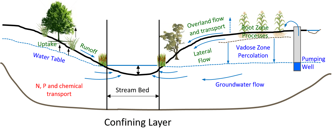
Hydrologic processes in RVSM:

HEC-RAS schematic with vegetation polygons:

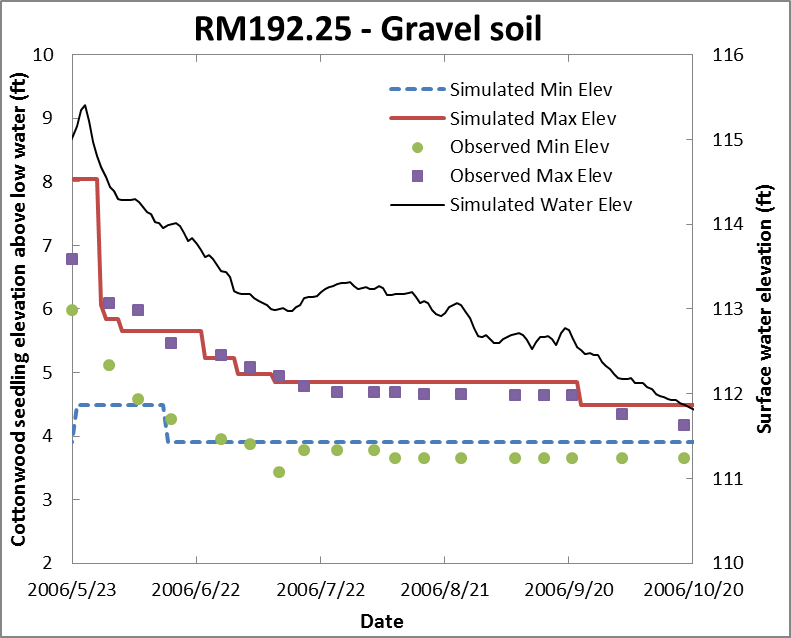
Cottonwood seedling occurrence by elevation – simulated by HEC-RAS-RVSM:


RVSM will be available in HEC-RAS v5.1, targeted for release in FY20.
ERDC POC:
Dr. Todd Steissberg
530-304-3510
clearwater@usace.army.mil
Last Updated: 02/13/2020